Kurt M Lawson Photography »

Masthead header

Some Oaks in the Snow

Trees have always been a favorite subject of mine. I’ve always loved the way they branch out in various ways in their quest for sunlight. In northeast Indiana the winter months would leave the trees bare and expose their innermost structures of stems, branches and twigs. One one day following a fresh snow I ventured out in search of something to shoot. Nearby I found this marvelous oak tree, covered in snow.

My original Snowy Tree photograph, taken in the late 1990's.

My original Snowy Tree photograph, taken in the late 1990's.

Now in 2009, Sunday’s snowfall gave me the opportunity to head out and take a nearly identical picture more than 10 years later:

Snowy Tree 2009

Snowy Tree 2009

With my comparison of thes two images when lined up, I can see that I was just a few feet away (to the left) of where I must have taken the original shot. The oak tree is very much the same although it has stretched outward a little bit. The seeming ancient technology used in the original – an Olympus OM-1N fully manual, mechanical camera body and film did a fantastic job capturing detail of the tree. This has, however been surpassed by my new 21 megapixel monster, which captures more detail with essentially no grain. Still, you’d have to do an enormous print to tell the difference. For entertainment value only, here are some crops of the same approximate area with the two pictures:

Crop from 4000dpi scan of original 35mm negative

Crop from 4000dpi scan of original 35mm negative


Crop from 5D Mark II image

Crop from 5D Mark II image

I also took some pictures in some nearly wooded areas of the park.
This oak tree caught my eye.

A leaning oak tree

A leaning oak tree

Leaning Oak detail

Leaning Oak detail

This picture came with a surprise. If the man had not moved I might not have even seen him. He was apparently watching what I was doing for a few minutes before moving on.

The man in the woods

The man in the woods

100% crop showing the man in the center of the path

100% crop showing the man in the center of the path

Finally, here is a look at the branches of the Snowy Tree.

Snowy Tree Detail

Snowy Tree Detail

I love the way the oak branches meander outward from the trunk. Perhaps I will try and come back during another season to see what this tree looks like when it’s covered in green or red. It’s just beautiful to see a large oak like the Snowy Tree after a fresh snowfall.

Mojave National Preserve Time Lapse

While I was exploring the Mojave National Preserve, I shot a couple bits of time lapse video. I was inspired to do so after I noticed how fast the clouds were moving. I knew that if I sped up the motion even more it would be interesting.

As I headed south I noticed the clouds were interacting with the mountains. Here is what that looked like:


Both videos were shot with my Canon 5D Mark II and sped up 15x faster.

Mojave National Preserve

Morning Star Mine Road

Morning Star Mine Road

Driving along I-15 on my way to Las Vegas I came across a sign that said to tune to 1610 AM on the radio to hear information about the Mojave National Preserve. Being quite bored along the 4 hour drive I decided to take a listen to see what info they were offering. After listening to the descriptions of various parts of the preserve, I decided to take a drive through on my way back. I decided to get off I-15 at Nipton Road and cut a diagonal path down to I-40 to continue my drive home.
I was impressed with the sheer desolation. It’s not the same as Death Valley National Park, as the vegetation is more dense but the wide open spaces are amazingly desolate. One thing the park did boast on the radio is the largest Joshua Tree forest in the world. I-15 cuts through part of this forest, and I soon met up with it again driving down Morning Star Mine Road.

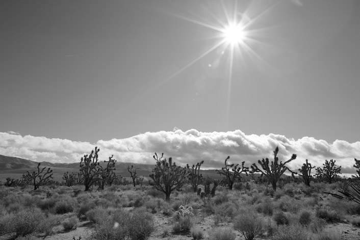
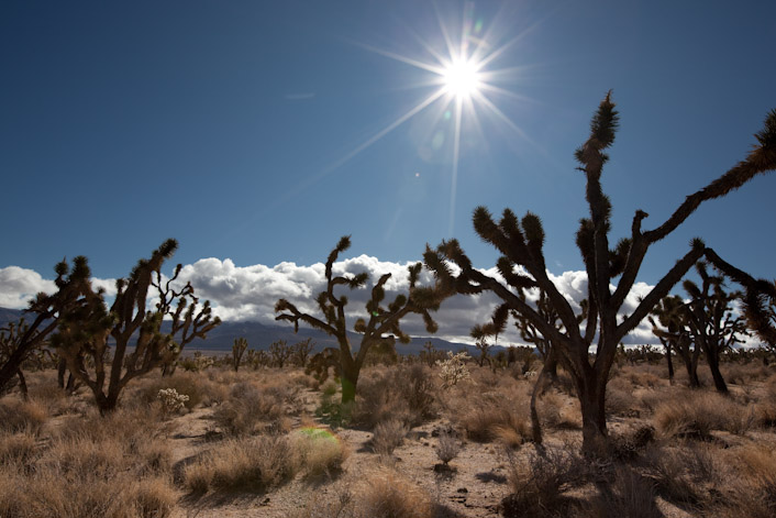
Joshua Trees

Joshua Trees

Part of the largest Joshua Tree forest in the world

Part of the largest Joshua Tree forest in the world

I only drove through the eastern fringe of the forest, however. The majority of the forest lies in the Shadow Valley area to the west.

Very large Joshua Tree

Very large Joshua Tree

Continuing on through the preserve, I spotted these towering dunes in the distance.

Kelso Dunes from afar

Kelso Dunes from afar

More Kelso Dunes

More Kelso Dunes

These dunes tower up to 640 feet

These dunes tower up to 650 feet

These giant dunes are visible for miles and miles around. I figured I’d take a closer look if there was suitable road access. Fortunately the turnoff for the dunes trailhead is a very well maintained dirt / gravel road that any car can drive on. I decided to take a closer look. There were a half dozen or so other people there exploring these dunes. Fortunately motorized vehicles are prohibited here.

Hikers making their way to the top

Hikers making their way to the top

I’ve read that these dunes are quite varied in their composition. The largest ones shown here (which are the closest to the trailhead) appear to be mostly vegetation stabilized and do not drift. I found the sand in some places was quite solid. I could walk over them with all my gear and hiking boots and would only leave impressions in the top centimeter or so of loose sand. In other places it was just as soft as a sand dune on an ocean coast. I ventured about a mile towards the tallest dune before deciding to head back.

In the Kelso dune field

In the Kelso dune field

Looking towards the Providence Mountains

Looking towards the Providence Mountains

Hikers on the top with blowing sand

Hikers on the top with blowing sand

All together it was a very nice diversion. The preserve has many other features that I did not touch on, including a nice cave system, volcanoes and other interesting bits. I’ll definitely go back for a proper photographic expedition.

Snow-capped Sunrise

Snow-capped Sunrise

Snow-capped Sunrise

In Los Angeles we have two seasons. The season when it won’t rain and the season when it might rain occasionally. This week we have definitely entered the latter with the arrival of a winter storm which produced snow levels down to just 1500 feet and sent temperatures down into the upper 30’s for the greater LA area. For this climate, that is very cold. For where I grew up, that would seem a rather balmy temperature about now as that same storm system slams the midwest. The thing about LA though is that the rain is very cleansing to the air and to the streets.

I set my alarm to wake up early on Tuesday morning with the idea being that I would head to Baldwin Hills Scenic Overlook and take a glorious picture of downtown LA with morning glow lighting up the fresh snow covered peaks in the San Gabriel Mountains and crystal clear air. Not having done any research I did not end up with what I wanted. I think what I was envisioning in my head is more apt to come at sunset if at all. If you look closely you can see the snow behind downtown LA in the early light. The first time it rained after I moved here was the first time I caught a glimpse of Old Baldy, the 10,068 foot peak on the eastern border of LA County. This behemoth was completely invisible the first month I was here. The next day the LA times had a picture of downtown LA with beautiful snowcapped mountains behind, and I’ve always wanted to take a shot like that myself. Now I know where to take it.

Snow over the Hollywood Sign

Snow over the Hollywood Sign

The Hollywood Sign showed some nice snow-capped peaks behind it. The light on the San Gabriels behind is what I had envisioned behind the LA skyline. The picture will also be better framed from a little further east at Kenneth Han park.

A jogger in the cold

A jogger in the cold

A fellow photographer with his hasselblad

A fellow photographer with his hasselblad

Always nice to see people shooting film, even if I don’t do much of that anymore.

As clear as it gets

As clear as it gets

Devil’s Gate Dam

The face of Devil's Gate Dam

The face of Devil's Gate Dam

Devil’s Gate Dam is a site where I took some photos of the Station Fire back in August. Until then, I had no idea that this dam existed, despite numerous trips to play frisbee golf at the nearby Oak Grove disc golf course. This 100 ft + dam is meant for flood water control and is also a huge line of defense in case of large mudflows coming down from the burned area. The light was not cooperating with me but I managed to get a couple of interesting shots of the Dam and the eroded Arroyo Seco watercourse running through it.

Looking down. A taste of fall color!

Looking down. A taste of fall color!

Miniature canyon

Miniature canyon

Wider view of the minature canyon with some fall color!

Wider view of the minature canyon with some fall color!

One last bit of the Arroyo Seco watercourse

One last bit of the Arroyo Seco watercourse

C o n n e c t
F l i c k r