Death Valley

Return to the Racetrack. No, the tracks don’t disappear with the next rain.

A Raccing Rock
A Racing Rock. The Racetrack is for rocks, not cars.

Back in September of 2016 I visited the Racetrack and really had quite a reaction to the inconsiderate vandalism that had happened there. Some people had driven all over the playa, including in at least one spot over the tracks of racing rocks themselves. This is a unique spot on the entire planet, and driving is not allowed here. I was not prepared for that post to go viral, and I ended up being interviewed by the very kind Domenica Davis via Facebook Live on the Weather Channel’s page and my post was republished in Petapixel and reference in DPReview and other places.

Here’s a few other things that have happened since then.

Death Valley National Park posted on Facebook about the damage, including a traced map of some of the tracks across the entire lake bed.

News outlets like the LA Times published articles saying “Federal investigators have identified a suspect believed responsible for a frenzy of high-speed driving across “Racetrack Playa,” a remote dry lake in Death Valley National Park” after which I have not seen any further updates.

I heard a rumor that someone had laid new tracks around Christmas 2016 but I had not seen any photos or posts or articles about it.

Other kinds of vandalism have happened, such as defacing of historic inscriptions, which Death Valley also posted about on Facebook. A van drove out onto the salt flats at Badwater and got stuck. This is another place where tracks can last a really long time.

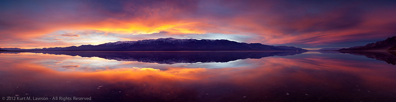
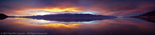
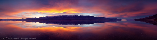
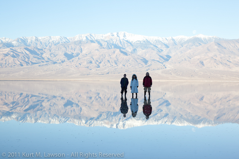
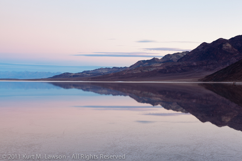
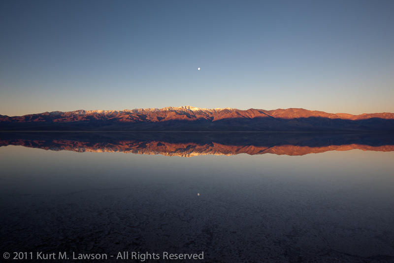
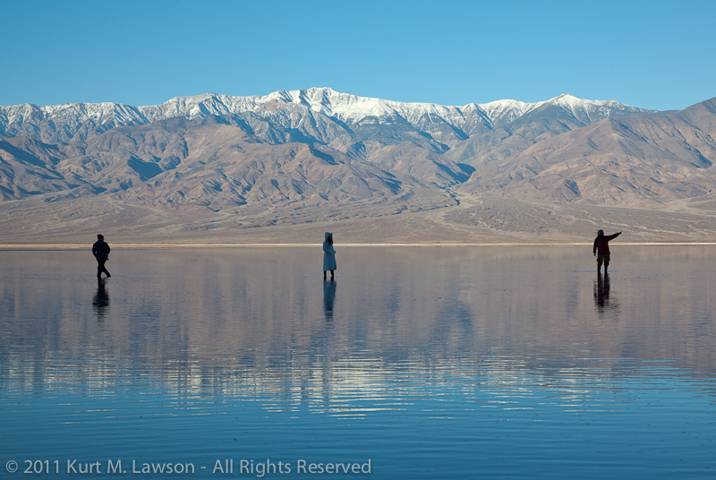
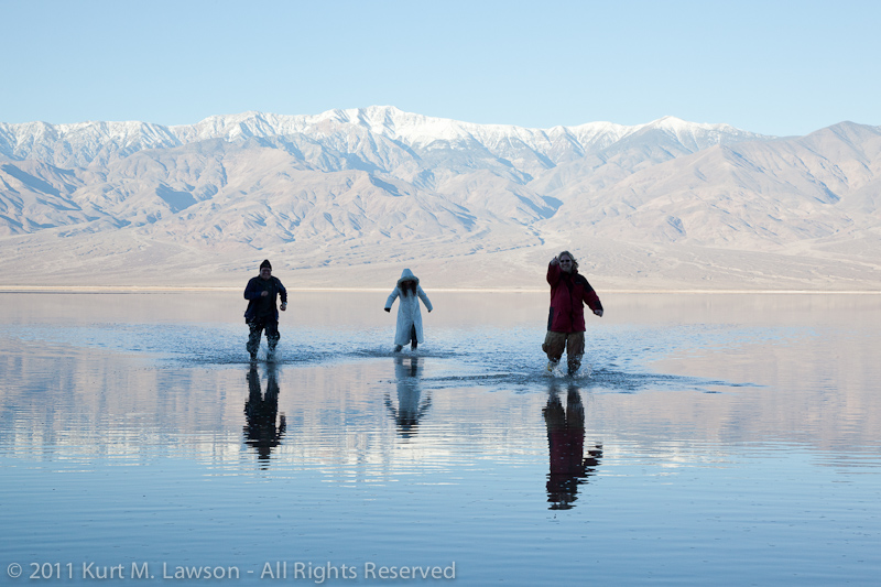
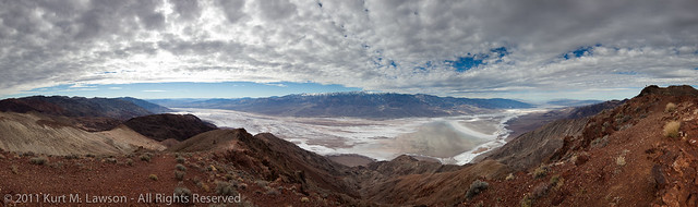
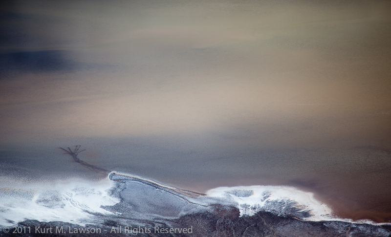
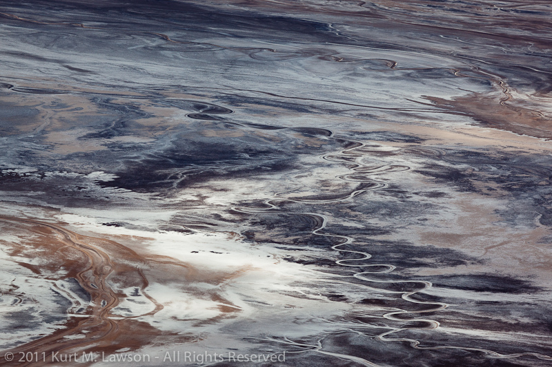
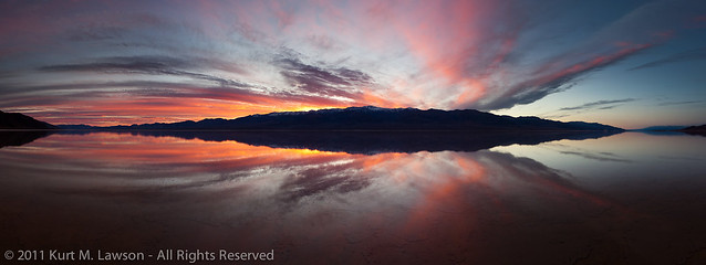
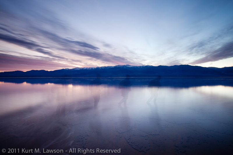
I visited the park three times, twice in January and once in February when Badwater flooded. Badwater when flooded is one of the most magical places I’ve ever seen, and home to the most incredible sunset I’ve so far witnessed in my lifetime. I hope to write posts about those visits at another time. A bunch of other priorities kept me from coming back to the Racetrack, however, until Memorial Day weekend. Plus, if Badwater was flooded that meant Racetrack Playa was likely flooded too, or at least wet, and you do not walk on it when it is wet. I wanted to go there with the specific purpose in mind of revisiting the damage that inspired so much anger last September and to see what the historically wet 2016-2017 winter has done to repair the damage, if at all.

Armed with GPS coordinates of photos I took last fall, I went straight for the Racetrack on Saturday, May 27th. I said some words to a car full of naive visitors in Panamint Valley who were feeding coyotes (DON’T!), and helped a family who had a minivan in need of a jump in Stovepipe Wells where it was nearly 110 degrees before finally I made the long dirt trek to one of my favorite locations in the world. Late May is already getting to be quite hot in Death Valley. I don’t like to come here when it is hot, but at least at nearly 4,000 feet elevation the Racetrack would only be in the mid 90’s.

Getting to the heart of the matter, I’m going to detail five kinds of vandalism that has happened around here, starting with the most obvious.

1. Vehicle Tracks

This is what greeted me in September 2016:

Tracks from the start

As you can see, tracks fly away right from the parking area. At first, in May it seemed a little more hopeful:

No tracks... for the first few feet
No tracks… for the first few feet

From this vantage point, we were looking good. I wondered if the NPS had done some rehabilitation of the area right next to the parking area, but all hope quickly faded away.

Just a few feet away toward the Grandstand, it begins.

Strange tracks leading towards the Grandstand, 2017
September 2016 looking towards the Grandstand

I tried to recreate exactly the photos I took in September, but alas a few factors were at work. First, I think the GPS from my phone was not very reliable when I took many of those photos. Second, there is definitely MORE damage than I remember from then, making tracks mixed up. And third, I quickly became overwhelmed with the quantity of tracks. So the next photos are all from the damage around the Grandstand, mostly between the Grandstand and the parking area. This damage is NOT part of what the National Park Service traced on their GPS map overlay.

Current damage as of May 2017:

So many tracks
So many tracks, May 2017
more..
more..
Strange double-track winding in from northwest
Double track gets really close to the Grandstand
All over
All over
Deep circles
Deep circles
Fresh looking motorcycle track crosses the older car tracks along with many footprints
Look how deep the car tracks are, and also all the footprints

Footprints are just as bad as car tracks! I’m glad the footprints didn’t venture far. Not all of the area around the Grandstand is currently in a ruined state, but most views to the East are polluted heavily by tracks. By my estimation, some of these tracks are new compared to my visit in September and others are the same. I wasn’t able to line up any exact photos of 1:1 damage between the two dates. However, I knew that Death Valley had posted that GPS map of some of the tracks and they were on the far east side. So I ventured out there to find those tracks as a measure of whether or not repair had happened this winter. More than 3/4 of a mile away from my car I found my answer. These next two photos are from the August 2016 joy ride that the National Park Service publicized not long after my viral blog post.

August 2016 tracks in May 2017
August 2016 tracks in May 2017 II

It’s safe to say NO, TRACKS DON’T DISAPPEAR AFTER “THE NEXT RAIN.”


These August 2016 tracks were very much not gone and judging by their depth they will be around quite awhile. Maybe years. If you think about it, it makes sense. The lake bed surface needs to soak to be vulnerable to reforming. Gentle winter rains are not going to come down with enough force to cause the sediment to stir up enough to fill in those deep vehicle grooves. Perhaps a violent summer thunderstorm could help, but it’s going to take some time before these scars heal. This is one of the driest deserts on the planet.

From the Grandstand I moved on to the middle parking area. This area was an absolute mess in 2016:

Middle parking area adjacent, 2016

To my astonishment after the Grandstand I found that here some of the tracks were either largely repaired or diminished, or perhaps my phone GPS logged the wrong location. That’s not to say I didn’t find tracks there.

Tracks at the middle parking area 2017

After this brief stop at the middle, I moved to the final parking area which is the one closest to the most rocks.

Car tracks heading straight out towards many rocks
Car tracks heading straight out towards many rocks, 2017

My heart sunk at the sight of this. I figured it didn’t bode well for this scene from September:

Car track crossing rock path 2016

I tried to navigate to this exact spot but I couldn’t find it despite having GPS coordinates. Where it was supposed to be there was no trail: no car trail and no rock trail. Since I took those photos with my phone, I think the GPS coordinates were possibly off quite a bit. I’m hoping it was repaired. I wondered around quite a bit and did not find any car trails that made it still into the main area of rocks. This has me yet again wondering if the NPS did some work out there to try to help repair the damage, or if nature was able to do a little healing at this end of the playa.

More 2016 rock adjacent damage that I was unable to locate

2. Footprints

You’ve already seen some pretty terrible footprints by the Grandstand parking area above, but there were plenty of other footprints at the south end too. DO NOT GO OUT ON THE PLAYA WHILE WET. Footprints can be just as bad as the tire tracks and last just as long, spoiling the experience for others who want to enjoy this magical place. A large cluster of footprints near the main rock parking area didn’t extend too far out but did go more than 1/4 mile out to some rocks. Whoever did this is incredibly inconsiderate.

Nasty footprints wandering off onto the playa
May 2017: Nasty footprints wandering off onto the playa
What a mess
What a mess

Who wants to see that? Those are going to be there awhile. Please don’t do this. Posted signs say not to walk on the playa when wet for this reason.

3. Fake rock trails

Fake rock trails? Yes. This is a new form of vandalism I had not previously imagined. It seems some people arrived at the Grandstand on the north end and had no idea most of the rocks are at the south end. Perhaps frustrated and lazy, they opted to attempt to make their own fake trails using available rocks. You can tell they are fake because they just scratch the surface. I’ve been to the Racetrack more than enough times to easily spot this stupid faking. The ice floating on the water drags the rocks along, and the marks they leave on the surface even with small rocks has a well defined channel unlike these surface scratches. Look at this stupidity:

Fake rock trails, sigh.

Don’t do this. My only comfort is maybe it’s good that such inconsiderate people didn’t make it to where the rocks really are.

4. Moving or Removing Rocks

Yes, people steal the rocks. This is a crime. Don’t move or steal rocks please.

Missing rock
Missing rock

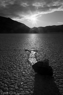
Where is the rock? It’s gone. When the rocks move, they leave trails. They only don’t leave trails when they are picked up and moved by humans. It’s heartbreaking and sad that people would do this. I’ve heard stories, and thankfully I have never witnessed anyone taking a rock myself. This photo is from 2008, so it’s not a new phenomenon, sadly. Apparently some people, before it was documented how the rocks move, thought the rocks themselves had some kind of mystical properties. The only mystical properties I hope the stolen rocks have is that they act as a curse upon the people that took them.

5. Defacing Rocks

While in the 8+ months since I first saw the massive extent of damage to this incredible unique place I reached a calm where my blood wasn’t boiling in documenting all this, but it still boils for this last one. This rock hasn’t moved since last September and there’s no word about any search for the awful people who did this. “D” and “K” should be banned from all national parks for life with this level of offense. The lake bed will heal one day. The rocks will not. These letters are chiseled into the rock, deep!

Defaced rock
Defaced rock, May 2017

Where’s the emoji for infinite rage? That’s what this makes me feel.

Final Thoughts

The Racetrack right now is still heartbreaking. Maybe that’s because in the past I’ve only seen some occasional footprints here, which in the long intervals between my visits have been repaired over a timeframe of years. There is just a whole new influx of selfish visitors reaching this place in recent years I guess. I fear it will get worse. Since the news stories and articles, the National Park Service I read was exploring various ideas to improve or change the Racetrack in response to these crimes including increased ranger patrols, volunteers, re-configuring the road, erecting barriers against cars, or other ideas. I should note that the massive proposed budget cut to the National Park Service certainly won’t help. Please contact your representative and encourage them to increase rather than decrease NPS funding! We need for the NPS to have the resources they need to protect our special places.

I haven’t seen any news reports about any charges in the case of the joyriders who left the tracks. I don’t know what direct evidence there is. The damage at the Racetrack has definitely made it harder for me to convince myself to make the trek out to the Racetrack. I’m not the only one to ponder whether visiting the Racetrack is even worth it anymore. (Note that link is an article from 3 years ago)

I find this valley to be absolutely spectacular though, even if the rocks were not there. So there’s definitely enjoyment to be had. If the bad people can stay away long enough and thus not cause more damage, eventually the surface of the lake will be repaired. In my head I keep going back to the magic of the first time I ever visited this place back in 2008. There were some really amazing tracks back then. Recent rock moving events have not produced such varied trails and I am ever hopeful for a really nasty and chaotic winter here so that really interesting new rock tracks can be naturally carved. It is a dynamic place but the change is slow, as evidenced by the deep trails from last summer still easily visible.

If you see someone defacing this place, document and report it. Especially if it’s the special type of jerk who would chisel into one of the rocks. That’s inexcusable. This is a special place. Help protect it!

One last bonus: there was one really unexpected thing I saw on this most recent trip to the Racetrack. It brought a smile to my face even.

Great Egret on the Grandstand

At sunrise on Sunday I went to the Grandstand for a change. And while I approached it I saw something that at first I figured was a person. But then it flew away as I got closer. It was a Great Egret. I think a very confused one. I don’t know what would lead such a water dwelling huge bird to end up at a dry playa in Death Valley National Park on the cusp of summer, but it was neat to see this magnificent creature here. As I explored it would fly away to another part of the Grandstand, keeping an eye on me. It never ceases to amuse me that such neat creatures with clear air superiority are so skittish about us gravity constrained humans. Death Valley is full of surprises, I hope when you visit you are pleasantly surprised.

Vandalism at the Racetrack, Death Valley National Park

Edit:
Hello, Internet! If you want to keep up with my photography, follow me on Flickr, Facebook, 500px, check out my other blog posts or even visit my portfolios. Cheers.

I haven’t done a blog post in awhile. I’ve been extremely busy. It’s not that there hasn’t been things to write about, but rather that all of my photographic efforts have been exhausted outside of the day job and it just hasn’t left me with anything left to devote to writing here. However, a trip last weekend to the Racetrack has left me with a burning need to write, and unfortunately it is because of the worst kind of people.

My mission was to capture some specific images of the Racetrack for a project. I made haste to get there as soon as I could before it got too hot. It is after all summer, and I wanted to get up to 3700ft before the main valley hit 110. It was in the upper 90’s when I finally started upon Racetrack Road. Oh Racetrack Road, you are still as bad as ever. Those 27 miles are always a relief when they are over. Finally, the Racetrack came into view. I was blissfully ignorant of what horrors were hidden from view at this distance. What follows is a mix of iPhone and Sony shots taken between 9/11/16 afternoon and 9/12/16 morning.

The Racetrack Playa finally in view

The Racetrack is a very special place. There are only two known places on the Earth where rocks move on their own across a lake bed. How they move was a mystery until 2014 when a couple of researchers finally witnessed it. The conditions have to be perfect, and those conditions might not happen for years between events. This is because of course Death Valley is a very dry place, which leads us to why the Racetrack itself is so fragile. When wet, footprints can last for years before conditions reach the point where the surface can reset. This is why signs say not to walk out on the lake bed when it is wet. Well, you are also not supposed to drive on it. This is regardless of whether it’s wet or dry. Unfortunately, when I drove up to the first of the three parking spaces, I found this.

Car tracks at the Grandstand

It seems the worst kind of people have recently visited the Racetrack. The worst kind of people.

If only there was a sign that said "NO MOTOR VEHICLES"
If only there was a sign that said “NO MOTOR VEHICLES”
They did loops around the Grandstand :(
They did loops around the Grandstand 🙁
It doesn't have to be wet to get damaged by inconsiderate people
It doesn’t have to be wet to get damaged by inconsiderate people

The Racetrack Playa has three parking areas. The middle parking lot offered even greater horrors. Whoever did this, they really had zero consideration for anyone else.

What a mess
What a mess

The damage was so extensive by the middle parking lot I couldn’t even bring myself to walk out and get a closer look. By this point my heart was really filled with dread. “Oh God, surely they didn’t go to the rocks too!” I thought. I pressed on.

Yes, they went there.

At least one track ventures all the way to the rocks. They were thorough in defacing one of the most unique places on Earth. Yes, that’s a track that curves between rocks before looping around. Photographic compositions here will be ruined for years. Experiences will be marred by tire tracks next to rock tracks. My planned shots around the Grandstand were ruined for this trip.

Horrors
Horrors
Yeah, the car tracks show up from afar too
The worst people drove right over some tracks
From the rocks area, car tracks tail off into the distance

It appeared that these people drove out right from the Racetrack parking area.

Tracks right from the Racetrack parking

I don’t recognize the type of tread. Anyone know what these are from? It seemed to be pretty recent. It can be quite windy and I would expect the wind to erase the soft prints in the sandy dirty here before long.

Treads of bad people

If I sound repetitive referring to these people as the worst, or bad, or terrible, or any number of other negative adjectives I’m not really sorry. This damage could last for years. The Racetrack is a special place. It’s not a place for cars to race, it’s a place for the Racing Rocks. Period. It’s a National Park. Be respectful. What I’m writing is incredibly tame compared to the thoughts that were racing through my mind as I came across this mess. This level of disrespectful, inconsiderate car track graffiti exceeded everything I previously thought possible. But unfortunately, the horrors would continue. 2016 has had abundant horrors.

Out at the rocks, some fainter trails of … something … crossed through some of the area. I don’t know what to make of them or how old they are, but they are just as abhorrent as the car tracks.

Human caused tracks of something crossing a rock trail

I don’t know what to make of this. At some other point on the playa there seemed to be bicycle tracks but the side-by-side nature here I find puzzling. This is minor compared to the final insult.

Chiseled into a rock, the initials of horrible people
Chiseled into a rock, the initials of truly horrible people

A few weeks back I had heard a rumor that I prayed was not true. The rumor was that people were carving initials into rocks at the Racetrack. It’s been bad enough over the years that people steal rocks and move them. But this, this really takes the cake. At least the damage to the playa surface will one day be undone by the weather, even though it could take decades. This though, this will last far longer. These people, “D” and “K” chiseled a 1/8″ deep graffiti gouge into the surface of a large rock on the playa.

How does one get it in their head that this is ok? How does one think “Oh, it’s the racetrack! Let’s drive on it!” How does one think “Let’s chisel our initials onto one of the special rocks!” How does one get to such a selfish place in life? I hope these people are caught. I know that hope is about as improbable as winning the Powerball lottery, but in a perfect world, these assholes would be brought to justice. Anyone with any information please contact Death Valley National park. Defacing the racetrack is a crime.

I wish that the entire racetrack could be surrounded with severe tire damage spikes, carefully camouflaged to blend in unnoticeable from the surrounding dirt. I imagine such a person as recently defaced this sacred place trying to drive upon the playa only to have all 4 tires shredded before they could damage much. This would necessitate a very, very expensive tow from Miller’s Towing out of Lone Pine. But such things are just thoughts. Please be respectful to our sacred and protected places. They belong to us, they don’t belong to just you. Please, if you know anything contact the National Park Service. Please don’t deface the Racetrack, drive on it, steal rocks, or chisel into the rocks.

Edit, Tuesday 9/20:

Thank you to everyone who has responded to this post. I did not expect it to take off as much as it has. Seeing those recent tracks was infuriating but they are hardly the first ones I’ve seen there. They are the worst kind of people to visit the Racetrack. To be clear, if it wasn’t obvious, I’m not comparing them to all the other bad people or bad things that happen on the Earth

A few people have claimed that the car trails will not last years. I present you this shot from 2013 of vehicle tracks that you cross between the parking lot and the main moving rock zone. While I did not take a photo of these tracks on 9/11-12 of this year (2016), they are just as present now as they were then. It is plainly visible in Google Earth.

Old vehicle tracks seen in 2013 still visible in 2016

I hope that the awareness instilled by this post will encourage others to document and report anytime they see anyone driving out there or defacing or stealing stones or walking out on the playa when wet. I hope it will encourage people to be respectful of this uniquely amazing place. And finally I hope that Death Valley National Park can do a little more to discourage driving out there and stealing / defacing rocks. There is certainly room for improvement in signage and in obstacles to getting out there. I want us all to be able to respectfully enjoy this amazing spot in my favorite National Park. Please enjoy the unique natural beauty of the sailing stones of the Racetrack and leave no trace that you were there.

And finally I’ll add one of my photos from my first ever visit to Death Valley and the Racetrack back in 2008, when I fell in love with this incredible place.

Racing Rock, 2008
Racing Rock, 2008

Please leave no trace.

Edit: I was interviewed live on Facebook by the Weather Channel’s wonderful Domenica Davis to talk about the damage and what makes the place special.

The Dynamic Salt Flats of Death Valley National Park

A northern view at Badwater, March 2013

During my first visit to Death Valley National Park, I shot some pictures at sunrise at a location known as Badwater. This is the lowest point in North America, at 282 feet below sea level and thus the final low point for water entering the vast salt pan that makes up the main valley floor. Of course, not all water makes it to this point, but this does fill with a few inches of water on occasion, and in 2005 was deep enough for people to kayak across for the first time. The salt flat was interesting in that first visit. For miles and miles, a pale white-grey texture of salt crystals formed polygons off into the horizon. Mostly, these were very low but were well defined by more dense concentrations of salt crystals. The polygons of mud crusted with salt varied from place to place, but mostly followed a fairly uniform set of characteristics through the main part of the Badwater salt flat area. Here is a view to the north in 2008:

A northern view at Badwater in 2008

All in all, I honestly didn’t find the Badwater area to be terribly interesting. I was intrigued by the contrast to the west when standing in the shadow of the Black Mountains while the Panamint Range was fully bathed in sunlight, but the actual ground didn’t inspire me on this first visit and I didn’t come back for a few years. In late December 2010 everything changed at Badwater. Heavy rains flooded the salt flat with several inches of water. Whatever the salt flats looked like prior to being flooded, the flood waters erased everything. This made for some awesome images, including many that are my personal all-time favorites. Here though is a similar angle during the day. You can see the mud under the water. There is no sign of the salt crystals or the vertical uplift of polygonal shapes. In fact, there’s nothing of the polygons at all. The surface has been erased back to flat mud, with little bits of texture dotting the underwater landscape.

A northern view at Badwater, January 2011

I made hundreds and hundreds of photos during the time Badwater was flooded. You can see some more here in my photo blog posts from two weekends there:
Tales of a Flooded Badwater
Tales of a Flooded Badwater Part II

As soon as I freed up from work again, I headed straight back in the hopes that the water might still be there. What I saw instead was a vastly different landscape.

A northerly view at Badwater, March 2011

The water was gone. There was fresh salt everywhere. There were no polygonal shapes, only dotted miniature mesas as far as the eye could see, and salt crystals so bright white that it was at least as bright as snow. I was blown away by the change in the landscape. I returned in November to shoot my Christmas card. This time new polygons had formed. The flats were still brilliant bright white crystal salt, however.

A northerly view at Badwater, November 2011

In January 2012, the polygonal surface looked different yet again:

A northerly view at Badwater, January 2012

And finally we get to the present day, which can be seen in the first image at the beginning of this post, and here is also a western view from the same location showing the extent of the uplift.

Western view at Badwater, March 2013

The mud and salt crust at Badwater to me resembles the very fundamental forces that created mountain ranges everywhere. Here is my hypothesis based on my own random visits and observations. It seems as though the mud and salt solidified after the flood in 2011 into a fairly consistent texture. Then, as the environment of Death Valley added and subtracted moisture to the salt flat, the crust began to expand and contract with the temperature changes and the forming and dissolving action with moisture. Eventually, cracks form which allow more moisture to seep through with more salt, concentrating the salt at the cracks. The overall cracked pattern appears like that of dried mud but on a larger scale, with some polygonal chunks a few feet across. With the concentration of salt along the cracks, the crystals there begin to push the plates apart from one another as they grow. This creates uplift at the edges as the different sections of crust expand outward and crack along the edges forming miniature mountain ranges. The current state of Badwater seems similar to what I found at the edges of a circular white salt flat in the middle of largely mud about 3/4 a mile from the road to the south of Badwater. Here along the edges the salt had fractured up nearly a foot off the floor, tapering off into more flat white patterns towards the center of the circle. So perhaps what is happening now at Badwater is similar to what was happening at the edges of this circle, indicating less and less water until ultimately the salt flat just turns into mud resembling the Devil’s Golf Course section.

Huge uplift at the edge of circular salt flat, March 2011

Badwater is a much more fascinating place to me now since that first visit in 2008, and I have new appreciation for the way the Death Valley landscape is constantly changing. I wonder if anyone has done a study of the stages of the changing landscape at Badwater. It certainly seems to have cycles. I wonder what it will look like during my next visit. I’m looking forward to finding out.

“Wow” redux, and my photography philosophy

WOW (redux)

While getting ready to print some of my all time favorite photos, I took a closer look at the panorama I simply called “WOW” back in January 2011. “WOW” was pretty much the only thought I could think as I witnessed the most intense and amazing sunset spectacle yet to appear before this photographer’s eyes. The setting is Badwater, the lowest point in North America in the heart of Death Valley National Park. Unusually heavy rains hammered the valley in December 2010, resulting in a flood of this lowest point, which is typically a salt flat with polygonal fractures forming miniature salty techtonic plates as far as the eye can see. Instead of that interesting and otherworldly scene, a dramatically different landscape greeted me. The entire basin was covered with a temporary lake. This was an opportunity I was waiting for. I fell in love with Death Valley after my first visit in January 2008 with my friend and fellow photographer Robert Mance. Not long after that first visit, I immersed myself in reading about this park and it’s amazing landscapes. During that research I discovered the flood of February 2005. Images of a flooded Badwater amazed me, and so did the thought of kayaking across this miniature lake, something no humans probably had ever done. I vowed to keep an eye on the weather in the future, and winter 2010-2011 would give me the chance to capture this rare event. You can read more about my January 2011 adventures in my Tales of a Flooded Badwater posts – part 1 and part 2. My second night on the first trip to a flooded Badwater would yield this panorama. “Wow” is what I said to myself repeatedly out loud into the emptiness of the valley. “Thank you!” I shouted to the landscape as I trudged back to my car through the 8 inches of salty water.

I thought I’d use this image as an example of how I will approach photographic post processing, as well as taking you through the steps I took with the “Wow” panorama to arrive at the final result. Lets begin.

For me photography is largely an interpretive art. The fun for me is in capturing something amazing that happens, and then sharing my interpretation of that through the artistic tools of photography. I try to keep things real when photographing landscapes. What I mean by that is that the landscape itself existed at the time I clicked the shutter. The quality of light is all there before the camera, recorded onto a piece of film or recorded by the electrical impulses of a CMOS or CCD sensor.

Photography is not how I make my living. I make my living as a compositor working on visual effects for movies. Think of it as “animated Photoshop” where images get combined in sequence to show movement rather than the single frame static scenes of photography. For a living, I make fake images. We call the “visual effects shots.” They might be totally transparent things that you wouldn’t notice unless someone told you – the removal of unwanted freckles on a face, the removal of reflections from a car, sky replacements, etc – or it could be completely obvious like adding the Lizard in a scene from the forthcoming Amazing Spiderman movie. All of these things may look real, but the end image is something that is no longer captured as far as I am concerned. It has crossed a line into something new that is created in post processing. Clearly, this is something highly subjective, so you are going to have to figure out where the line is for you.

It’s pretty simple for most images to me. Did I capture this scene, or did I create it later on my computer? The world of digital photography allows for limitless digital modification of images. People can remove trees they don’t like, change the sky, radically change and enhance the colors, composite elements together endlessly. If I took a photo from Death Valley and replaced the sky with one I shot at El Matador State Beach in Malibu, CA, can I still call it a “Death Valley” photograph? For me the answer is a definitive no. If I add in an over-sized moon dominating the sky of my image in Death Valley, is that something I captured or created? I’ve seen a lot of other photographers add moons to their shots, often huge moons that are astronomically and optically impossible. I think there are many people who view moons in landscape photographs with some suspicion due to the prevalence of bad moon composites. The bottom line: is this an image of a landscape that existed at the time I clicked the shutter, or is this something that could exist. For me a photography is all about the former, and the later is the realm of composites, digital art and visual effects shot. I want to capture reality with my photography. My day job of visual effects is for fake images. This is my philosophy. If you want to read an article arguing for more artistic license, Alain Briot has this article about Artistic License over at Luminous Landscape. Also, please note that composites are not the sole realm of digital photography. Jerry Uelsmann has done truly amazing composites in the darkroom long before photoshop became a verb.

This doesn’t mean I reject outright a lot of these tools that are available. Instead, I use them sometimes to overcome limitations of the camera system I’m using. The biggest example of this is images with huge dynamic range. In a few very select cases I have combined two exposures to lower the exposure of the sky when there is a scene of a dark foreground. This image from the Racetrack in Death Valley is an example. I used an underexposed bracket to bring back some detail where the sun had overexposed: (click for bigger)

Racing Rock

This used the compositing power of photoshop to simply compress the dynamic range a little. The scene was not fundamentally altered in any way, and now is closer to what I saw. But wait! That’s black and white! That brings me to:

Black and White Photography

Black and white photography will always be a more liberal interpretation of a scene than color photography. My childhood photography hero Ansel Adams captured amazing scenes and then used his masterful darkroom skills to extract an amazing “performance” from the negative “score.” I will sometimes do some light dodging and burning (increasing or decreasing exposure selectively) in some of my photographs, mostly with black and white interpretations which is not a way the human eye sees. You still wont’ find me adding moons that were not there and skies that were shot at a different place and time. If we use the Ansel Adams analogy I mentioned about the negative being like a musical score and the performance is the print, then I would say I am not going to change out whole sections of music by inserting parts of other scores.

Star Trails and other things the human eye just can’t see

Some photography is by its very nature fundamentally different than the way the human eye sees. I am rather fond of star trail photographs, and the human eye can’t see star trails looking up at the night sky. All my star trail shots are captured at once. I haven’t yet tried to use the “stacking” technique of combining multiple exposures into one star trail image. For really long exposures I just use film.

Panoramas

Finally, we get to my example image, which is a panorama from the flooded Badwater in Death Valley where we began. One compositing technique I have no problem using is combining multiple exposures into a panorama. The result is a super high resolution image that would exceed the capabilities of the camera. The trick is that you have to be quick about it when the light is changing. My technique is to set the camera on manual and carefully and quickly fire off 3 bracket exposures, then rotate the camera, repeat. Manual focus is also important. I’ve had numerous panoramas ruined by changing focus between frames. I always bracket exposures because I don’t trust myself, and I may want the option to restore some detail in an otherwise blown out section of the frame.

I have just gone through and completely reprocessed the “Wow” panorama as I get ready to print it (the print will be 18 by 70 inches). Why reprocess it? Well with the arrival of Lightroom 4.x, I’ve noticed that images just look better. Lightroom 4 does a much better job with highlights, rolling them off more gracefully. I felt that this image could benefit from some of that. Here are my brackets. The base exposure was 0.8 seconds at f/16 iso 200. A UV filter was on 16-35mm f2.8L II lens at 24mm. Bracket exposures were +/- 2 stops.

Brackets for central panorama image

The 7 frames of this panorama

This is the three raw files with all settings at default in Lightroom. From here I selected the “normal” exposure. This frame seemed to be the best balance of exposure. Looking at the histogram, the image data bunched up to the right without hitting the wall, meaning no pixels are exceeding the range the sensor could record. Having the pixels bunched up to the right also tends to result in an image with less noise as digital camera noise tends to be very prevalent in underexposed areas in most RAW files.

Notice that this panorama has 7 images. This was not planned. Normally, I would also try to shoot the panorama vertically to record more overall information. However, in a somewhat panicked panorama frenzy, I shot several different panoramas through the magic moments of this sunset. I didn’t know what the light was going to do so I just kept shooting. There are panoramas in my raw library of 6-14 images at all different focal lengths. In retrospect I should have at least had the camera vertically mounted, but that’s hindsight. The light I have decided, was the best at this moment. The panoramas before and after this are just not as dramatic, and this moment was dramatic.

So next I think about what I want to accomplish with the post processing. In this case I am making some adjustments to the overall exposure level and contrast. Besides that I want to darken the sky a little to equalize it with the reflected sky, and then that’s pretty much it besides stitching the panorama together and a pinch of sharpening. Can’t forget dust removal too. I hate sensor dust. Here are the adjustments. I’m not going to go into too much detail as to what each function does, since there are plenty of other resources as to how lightroom’s controls work.

The raw image ready to go in Lightroom

Basic contrast, exposure and black level adjustments applied

Slight tone curve adjustment

Digital graduated ND filters, profile corrections, noise and sharpening

The final result, which I felt captured the essence of what it was like standing there:
Central panorama image with all adjustments

I felt like I was between two worlds. The reflection quality was incredible due to the lack of wind. I didn’t adjust saturation / color controls at all. The color is all “straight from the camera”, though there is a natural increase of saturation by darkening the image down a little. I didn’t feel it needed anything else.

A quick synchronize of settings across the 7 images and everything looked good, except for the far right. In that image the Black Mountains had become really black, so I added a grad in the last image of shadows +35 all the way across the frame to feather detail back into the blackness.

Now it was time to stitch. I exported full size 16-bit TIFF files of each of the 7 images and had Autopano Giga look at the folder.

Autopano Giga's automatic panorama stitch

In just a few seconds Autopano Giga produced a panorama that was 99% of where I wanted it to be. I ended up exporting the panorama setup to PTGui Pro to do a couple of fine tweaks. I probably could have done the tweaks in Autopano, but I’m not as familiar with it. I used PTGui since before you could automatically generate any points at all. I added a couple control points, re-centered and rotated the panorama slightly to try and keep the horizon as centered and straight as possible. Here’s a screenshot of PTGui Pro showing where the stitch points are:

PTGui showing stitch pionts

I love that Autopano Pro can export setups to PTGui, which I can then tweak.

I think the end result is better. Here’s the original (click for bigger):

WOW

And here is my reprocessing (click for bigger):

WOW (redux)

Summary

So there you have one example of my post processing. I don’t do any content-altering compositing. I will use technology to overcome camera limitations such as dynamic range problems (though none of that tone mapped over-processed HDR stuff) and combining images to make panoramas that were shot at the same time (within seconds of each other). I don’t add a moon to shots that didn’t have it. I don’t replace skies with skies shot at other times or places. I don’t remove trees that I don’t like. I capture and then interpret reality. I’m not out to create a fantasy land visual effects shot. I don’t want to create images that could exist. “Here’s what I saw” is what I want my photography to be, not “here’s what I made up in Photoshop.” This is just my philosophy, and I hope you enjoy my photography as I share it. Not every landscape needs to be retouched as much as your average model shot. Nature isn’t perfect, and neither are my photographs. I hope maybe at least a little that my photography will inspire you to go out and see the natural beauty that is in the world around us. It’s everywhere, you just have to look.

Please comment below and let me know what you think.

A flooded Badwater Part II

Triple Portrait at Badwater

After my first visit to a flooded Badwater, I knew I had to get back as soon as possible. The impact of the water there compelled me to make every effort to come back. I was still riding a wave of excitement at the images that I was able to capture using my experience and pure luck to be at the right place at the right time. This time I brought two close friends with me to share in the experience. Although I do enjoy the solitude of my photographic passion, it is also great to share the experience. Not having the Friday off from our day jobs, we made the long drive in the dark of Friday evening to prepare for a sunrise at the flooded Badwater. I had shot sunset there twice the previous trip but not sunrise (with some regret). With an evaporation rate of 128 inches a year (about 77x the precipitation rate), I knew I needed to get back fast if the water was going to still be there. The mild temperatures of the Death Valley winter had kept the water there longer than I thought already and there was no telling how long it would last. Fortunately, as you can see, the water was very much still there.

Quiet symmetry

Before sunrise, you can see the very shadow of the Earth as it is chased away by the light. Here I’m looking at a pair of other photographers over by the park’s pull off for Badwater. You can see their little specs on the right of the image. Earth’s gorgeous blue shadow can be seen to the left. Sunrise was imminent.

Day's leading edge

We watched the quiet light on this windless morning until the sun reached all the way down the Panamint Range. The reflections were a perfect mirror. After the light became more harsh, we decided to have some fun doing some self portraits with the reflected water. Our triple self portrait is at the start of this post. Setting the camera to repeatedly take photos, we walked out and held still so that all the ripples would vanish (about 5 minutes). Then we had some fun.

Over there!

Running on Water

We had a blast, and at the end we were all covered with salty deposits from the splashing water. These photos are challenging because of the light. The entire world around us and the reflections in the water are powered by direct sunlight. Where we were standing was in complete shadow from the Black Mountains behind the camera. Producing anything other than a silhouette stretched the limits of my 5D2’s dynamic range. That’s me on the left!

Eventually, we headed in for breakfast to decide where to head next. I usually like to stop at the 49’er cafe in Furnace Creek for a nice big breakfast after running around in the valley all morning. After breakfast, a trip to Dante’s View was in order. This would allow us to get a complete overview of just how much water there was at Badwater and allow us to scout where to head next. And as luck would have it, clouds were building. From a mile up, the extent of the water was made clear. Click for a much bigger version of this panorama.

Death Valley Panorama from Dante's View

The clouds were moving by quickly, casting shadows on the valley floor. I made a time lapse video of the action:

It was beautiful. Looking down below we spotted something weird.

An alien hand reaches into the water

We were certainly disturbing the mud was we walked through the water in the morning. What we didn’t realize was just how visible that would be from above! Here you can clearly see the tracks we made through the water. It looks like an alien hand reaching out from the shore. Fortunately are marks were not permanent as they would disappear once the silt settled, later to be covered with white salt when the water was gone.

The views below were crazy. The water increased contrast throughout the valley, emphasizing twists and turns of the water as it snaked its way to the lowest place in North America.

Snakes on a plain

Looking down into a brownish reflection of the clouds above, you an make out the main path that park visitors take in the lower right of this image, and our alien hand on the left.

Cloud reflections in a flooded Badwater

With the cloud cover, we resolved to head back down to Badwater for what could turn into another amazing reflected sunset. On the way back down, a section of the mountains caught my eye.

Folds of rock

Here you can see the tortured history of the valley laid bare. It’s hard to imagine the forces that would take layers of solid rock and bend them 90 degrees.

Again the skies of Death Valley blessed us with a wonderful reflected sunset (click for bigger)

Extra glow sunset at Badwater

It’s a bit hard to describe what it felt like to be there, standing in a motionless mirror of water while this incredible show happens before your eyes. The reflection really makes it almost like you’re floating in space around planet sunset. It’s really awesome and I hope my photos can convey that on at least some small level. After the sun had set, it became self portrait time again. This is actually one of my favorite pictures from the trip. There are four of me here.

Badwater Self Portrait

Here is a comparison to show the extent of the flood and what it looks like without any water. In March I returned for a third trip to Death Valley, and once again looked down on Badwater. The view then was completely different. A vast white field of fresh salt deposits replaced the reflecting lake.

Dante's View of a flooded Badwater

Dante's View of a freshly salted Badwater

Poof! The water was gone in just two months. With 6 inches of water (maybe a little more) in January, that’s over 1/2 inch a week sucked up into the dry air.

Here are a few more pictures from this wonderful trip

Salty shores and morning haze

Soft shades of erosion

There’s much more to talk about with Death Valley this year, particularly in the realm of star trails. Check back for some more updates from this amazing place.