Desert

Vandalism at the Racetrack, Death Valley National Park

Edit:
Hello, Internet! If you want to keep up with my photography, follow me on Flickr, Facebook, 500px, check out my other blog posts or even visit my portfolios. Cheers.

I haven’t done a blog post in awhile. I’ve been extremely busy. It’s not that there hasn’t been things to write about, but rather that all of my photographic efforts have been exhausted outside of the day job and it just hasn’t left me with anything left to devote to writing here. However, a trip last weekend to the Racetrack has left me with a burning need to write, and unfortunately it is because of the worst kind of people.

My mission was to capture some specific images of the Racetrack for a project. I made haste to get there as soon as I could before it got too hot. It is after all summer, and I wanted to get up to 3700ft before the main valley hit 110. It was in the upper 90’s when I finally started upon Racetrack Road. Oh Racetrack Road, you are still as bad as ever. Those 27 miles are always a relief when they are over. Finally, the Racetrack came into view. I was blissfully ignorant of what horrors were hidden from view at this distance. What follows is a mix of iPhone and Sony shots taken between 9/11/16 afternoon and 9/12/16 morning.

The Racetrack Playa finally in view

The Racetrack is a very special place. There are only two known places on the Earth where rocks move on their own across a lake bed. How they move was a mystery until 2014 when a couple of researchers finally witnessed it. The conditions have to be perfect, and those conditions might not happen for years between events. This is because of course Death Valley is a very dry place, which leads us to why the Racetrack itself is so fragile. When wet, footprints can last for years before conditions reach the point where the surface can reset. This is why signs say not to walk out on the lake bed when it is wet. Well, you are also not supposed to drive on it. This is regardless of whether it’s wet or dry. Unfortunately, when I drove up to the first of the three parking spaces, I found this.

Car tracks at the Grandstand

It seems the worst kind of people have recently visited the Racetrack. The worst kind of people.

If only there was a sign that said "NO MOTOR VEHICLES"
If only there was a sign that said “NO MOTOR VEHICLES”
They did loops around the Grandstand :(
They did loops around the Grandstand 🙁
It doesn't have to be wet to get damaged by inconsiderate people
It doesn’t have to be wet to get damaged by inconsiderate people

The Racetrack Playa has three parking areas. The middle parking lot offered even greater horrors. Whoever did this, they really had zero consideration for anyone else.

What a mess
What a mess

The damage was so extensive by the middle parking lot I couldn’t even bring myself to walk out and get a closer look. By this point my heart was really filled with dread. “Oh God, surely they didn’t go to the rocks too!” I thought. I pressed on.

Yes, they went there.

At least one track ventures all the way to the rocks. They were thorough in defacing one of the most unique places on Earth. Yes, that’s a track that curves between rocks before looping around. Photographic compositions here will be ruined for years. Experiences will be marred by tire tracks next to rock tracks. My planned shots around the Grandstand were ruined for this trip.

Horrors
Horrors
Yeah, the car tracks show up from afar too
The worst people drove right over some tracks
From the rocks area, car tracks tail off into the distance

It appeared that these people drove out right from the Racetrack parking area.

Tracks right from the Racetrack parking

I don’t recognize the type of tread. Anyone know what these are from? It seemed to be pretty recent. It can be quite windy and I would expect the wind to erase the soft prints in the sandy dirty here before long.

Treads of bad people

If I sound repetitive referring to these people as the worst, or bad, or terrible, or any number of other negative adjectives I’m not really sorry. This damage could last for years. The Racetrack is a special place. It’s not a place for cars to race, it’s a place for the Racing Rocks. Period. It’s a National Park. Be respectful. What I’m writing is incredibly tame compared to the thoughts that were racing through my mind as I came across this mess. This level of disrespectful, inconsiderate car track graffiti exceeded everything I previously thought possible. But unfortunately, the horrors would continue. 2016 has had abundant horrors.

Out at the rocks, some fainter trails of … something … crossed through some of the area. I don’t know what to make of them or how old they are, but they are just as abhorrent as the car tracks.

Human caused tracks of something crossing a rock trail

I don’t know what to make of this. At some other point on the playa there seemed to be bicycle tracks but the side-by-side nature here I find puzzling. This is minor compared to the final insult.

Chiseled into a rock, the initials of horrible people
Chiseled into a rock, the initials of truly horrible people

A few weeks back I had heard a rumor that I prayed was not true. The rumor was that people were carving initials into rocks at the Racetrack. It’s been bad enough over the years that people steal rocks and move them. But this, this really takes the cake. At least the damage to the playa surface will one day be undone by the weather, even though it could take decades. This though, this will last far longer. These people, “D” and “K” chiseled a 1/8″ deep graffiti gouge into the surface of a large rock on the playa.

How does one get it in their head that this is ok? How does one think “Oh, it’s the racetrack! Let’s drive on it!” How does one think “Let’s chisel our initials onto one of the special rocks!” How does one get to such a selfish place in life? I hope these people are caught. I know that hope is about as improbable as winning the Powerball lottery, but in a perfect world, these assholes would be brought to justice. Anyone with any information please contact Death Valley National park. Defacing the racetrack is a crime.

I wish that the entire racetrack could be surrounded with severe tire damage spikes, carefully camouflaged to blend in unnoticeable from the surrounding dirt. I imagine such a person as recently defaced this sacred place trying to drive upon the playa only to have all 4 tires shredded before they could damage much. This would necessitate a very, very expensive tow from Miller’s Towing out of Lone Pine. But such things are just thoughts. Please be respectful to our sacred and protected places. They belong to us, they don’t belong to just you. Please, if you know anything contact the National Park Service. Please don’t deface the Racetrack, drive on it, steal rocks, or chisel into the rocks.

Edit, Tuesday 9/20:

Thank you to everyone who has responded to this post. I did not expect it to take off as much as it has. Seeing those recent tracks was infuriating but they are hardly the first ones I’ve seen there. They are the worst kind of people to visit the Racetrack. To be clear, if it wasn’t obvious, I’m not comparing them to all the other bad people or bad things that happen on the Earth

A few people have claimed that the car trails will not last years. I present you this shot from 2013 of vehicle tracks that you cross between the parking lot and the main moving rock zone. While I did not take a photo of these tracks on 9/11-12 of this year (2016), they are just as present now as they were then. It is plainly visible in Google Earth.

Old vehicle tracks seen in 2013 still visible in 2016

I hope that the awareness instilled by this post will encourage others to document and report anytime they see anyone driving out there or defacing or stealing stones or walking out on the playa when wet. I hope it will encourage people to be respectful of this uniquely amazing place. And finally I hope that Death Valley National Park can do a little more to discourage driving out there and stealing / defacing rocks. There is certainly room for improvement in signage and in obstacles to getting out there. I want us all to be able to respectfully enjoy this amazing spot in my favorite National Park. Please enjoy the unique natural beauty of the sailing stones of the Racetrack and leave no trace that you were there.

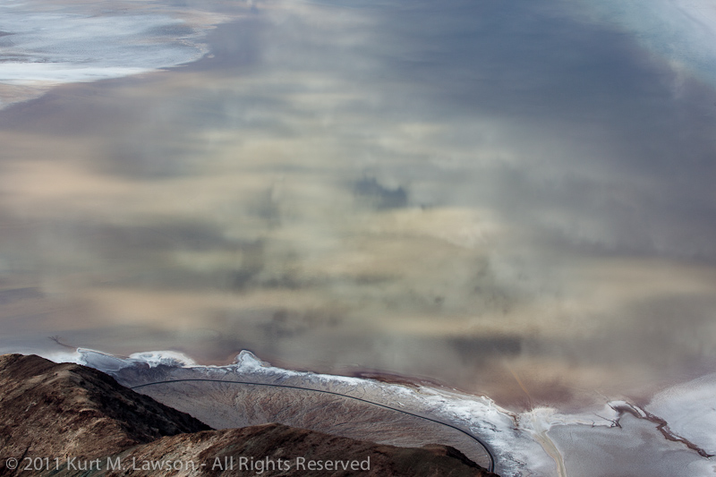
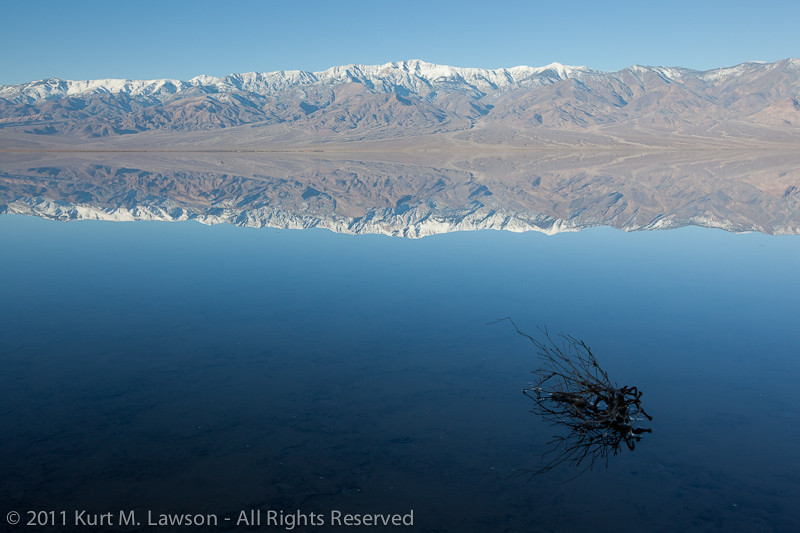
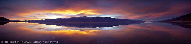
And finally I’ll add one of my photos from my first ever visit to Death Valley and the Racetrack back in 2008, when I fell in love with this incredible place.

Racing Rock, 2008
Racing Rock, 2008

Please leave no trace.

Edit: I was interviewed live on Facebook by the Weather Channel’s wonderful Domenica Davis to talk about the damage and what makes the place special.

The Dynamic Salt Flats of Death Valley National Park

A northern view at Badwater, March 2013

During my first visit to Death Valley National Park, I shot some pictures at sunrise at a location known as Badwater. This is the lowest point in North America, at 282 feet below sea level and thus the final low point for water entering the vast salt pan that makes up the main valley floor. Of course, not all water makes it to this point, but this does fill with a few inches of water on occasion, and in 2005 was deep enough for people to kayak across for the first time. The salt flat was interesting in that first visit. For miles and miles, a pale white-grey texture of salt crystals formed polygons off into the horizon. Mostly, these were very low but were well defined by more dense concentrations of salt crystals. The polygons of mud crusted with salt varied from place to place, but mostly followed a fairly uniform set of characteristics through the main part of the Badwater salt flat area. Here is a view to the north in 2008:

A northern view at Badwater in 2008

All in all, I honestly didn’t find the Badwater area to be terribly interesting. I was intrigued by the contrast to the west when standing in the shadow of the Black Mountains while the Panamint Range was fully bathed in sunlight, but the actual ground didn’t inspire me on this first visit and I didn’t come back for a few years. In late December 2010 everything changed at Badwater. Heavy rains flooded the salt flat with several inches of water. Whatever the salt flats looked like prior to being flooded, the flood waters erased everything. This made for some awesome images, including many that are my personal all-time favorites. Here though is a similar angle during the day. You can see the mud under the water. There is no sign of the salt crystals or the vertical uplift of polygonal shapes. In fact, there’s nothing of the polygons at all. The surface has been erased back to flat mud, with little bits of texture dotting the underwater landscape.

A northern view at Badwater, January 2011

I made hundreds and hundreds of photos during the time Badwater was flooded. You can see some more here in my photo blog posts from two weekends there:
Tales of a Flooded Badwater
Tales of a Flooded Badwater Part II

As soon as I freed up from work again, I headed straight back in the hopes that the water might still be there. What I saw instead was a vastly different landscape.

A northerly view at Badwater, March 2011

The water was gone. There was fresh salt everywhere. There were no polygonal shapes, only dotted miniature mesas as far as the eye could see, and salt crystals so bright white that it was at least as bright as snow. I was blown away by the change in the landscape. I returned in November to shoot my Christmas card. This time new polygons had formed. The flats were still brilliant bright white crystal salt, however.

A northerly view at Badwater, November 2011

In January 2012, the polygonal surface looked different yet again:

A northerly view at Badwater, January 2012

And finally we get to the present day, which can be seen in the first image at the beginning of this post, and here is also a western view from the same location showing the extent of the uplift.

Western view at Badwater, March 2013

The mud and salt crust at Badwater to me resembles the very fundamental forces that created mountain ranges everywhere. Here is my hypothesis based on my own random visits and observations. It seems as though the mud and salt solidified after the flood in 2011 into a fairly consistent texture. Then, as the environment of Death Valley added and subtracted moisture to the salt flat, the crust began to expand and contract with the temperature changes and the forming and dissolving action with moisture. Eventually, cracks form which allow more moisture to seep through with more salt, concentrating the salt at the cracks. The overall cracked pattern appears like that of dried mud but on a larger scale, with some polygonal chunks a few feet across. With the concentration of salt along the cracks, the crystals there begin to push the plates apart from one another as they grow. This creates uplift at the edges as the different sections of crust expand outward and crack along the edges forming miniature mountain ranges. The current state of Badwater seems similar to what I found at the edges of a circular white salt flat in the middle of largely mud about 3/4 a mile from the road to the south of Badwater. Here along the edges the salt had fractured up nearly a foot off the floor, tapering off into more flat white patterns towards the center of the circle. So perhaps what is happening now at Badwater is similar to what was happening at the edges of this circle, indicating less and less water until ultimately the salt flat just turns into mud resembling the Devil’s Golf Course section.

Huge uplift at the edge of circular salt flat, March 2011

Badwater is a much more fascinating place to me now since that first visit in 2008, and I have new appreciation for the way the Death Valley landscape is constantly changing. I wonder if anyone has done a study of the stages of the changing landscape at Badwater. It certainly seems to have cycles. I wonder what it will look like during my next visit. I’m looking forward to finding out.

A flooded Badwater Part II

Triple Portrait at Badwater

After my first visit to a flooded Badwater, I knew I had to get back as soon as possible. The impact of the water there compelled me to make every effort to come back. I was still riding a wave of excitement at the images that I was able to capture using my experience and pure luck to be at the right place at the right time. This time I brought two close friends with me to share in the experience. Although I do enjoy the solitude of my photographic passion, it is also great to share the experience. Not having the Friday off from our day jobs, we made the long drive in the dark of Friday evening to prepare for a sunrise at the flooded Badwater. I had shot sunset there twice the previous trip but not sunrise (with some regret). With an evaporation rate of 128 inches a year (about 77x the precipitation rate), I knew I needed to get back fast if the water was going to still be there. The mild temperatures of the Death Valley winter had kept the water there longer than I thought already and there was no telling how long it would last. Fortunately, as you can see, the water was very much still there.

Quiet symmetry

Before sunrise, you can see the very shadow of the Earth as it is chased away by the light. Here I’m looking at a pair of other photographers over by the park’s pull off for Badwater. You can see their little specs on the right of the image. Earth’s gorgeous blue shadow can be seen to the left. Sunrise was imminent.

Day's leading edge

We watched the quiet light on this windless morning until the sun reached all the way down the Panamint Range. The reflections were a perfect mirror. After the light became more harsh, we decided to have some fun doing some self portraits with the reflected water. Our triple self portrait is at the start of this post. Setting the camera to repeatedly take photos, we walked out and held still so that all the ripples would vanish (about 5 minutes). Then we had some fun.

Over there!

Running on Water

We had a blast, and at the end we were all covered with salty deposits from the splashing water. These photos are challenging because of the light. The entire world around us and the reflections in the water are powered by direct sunlight. Where we were standing was in complete shadow from the Black Mountains behind the camera. Producing anything other than a silhouette stretched the limits of my 5D2’s dynamic range. That’s me on the left!

Eventually, we headed in for breakfast to decide where to head next. I usually like to stop at the 49’er cafe in Furnace Creek for a nice big breakfast after running around in the valley all morning. After breakfast, a trip to Dante’s View was in order. This would allow us to get a complete overview of just how much water there was at Badwater and allow us to scout where to head next. And as luck would have it, clouds were building. From a mile up, the extent of the water was made clear. Click for a much bigger version of this panorama.

Death Valley Panorama from Dante's View

The clouds were moving by quickly, casting shadows on the valley floor. I made a time lapse video of the action:

It was beautiful. Looking down below we spotted something weird.

An alien hand reaches into the water

We were certainly disturbing the mud was we walked through the water in the morning. What we didn’t realize was just how visible that would be from above! Here you can clearly see the tracks we made through the water. It looks like an alien hand reaching out from the shore. Fortunately are marks were not permanent as they would disappear once the silt settled, later to be covered with white salt when the water was gone.

The views below were crazy. The water increased contrast throughout the valley, emphasizing twists and turns of the water as it snaked its way to the lowest place in North America.

Snakes on a plain

Looking down into a brownish reflection of the clouds above, you an make out the main path that park visitors take in the lower right of this image, and our alien hand on the left.

Cloud reflections in a flooded Badwater

With the cloud cover, we resolved to head back down to Badwater for what could turn into another amazing reflected sunset. On the way back down, a section of the mountains caught my eye.

Folds of rock

Here you can see the tortured history of the valley laid bare. It’s hard to imagine the forces that would take layers of solid rock and bend them 90 degrees.

Again the skies of Death Valley blessed us with a wonderful reflected sunset (click for bigger)

Extra glow sunset at Badwater

It’s a bit hard to describe what it felt like to be there, standing in a motionless mirror of water while this incredible show happens before your eyes. The reflection really makes it almost like you’re floating in space around planet sunset. It’s really awesome and I hope my photos can convey that on at least some small level. After the sun had set, it became self portrait time again. This is actually one of my favorite pictures from the trip. There are four of me here.

Badwater Self Portrait

Here is a comparison to show the extent of the flood and what it looks like without any water. In March I returned for a third trip to Death Valley, and once again looked down on Badwater. The view then was completely different. A vast white field of fresh salt deposits replaced the reflecting lake.

Dante's View of a flooded Badwater

Dante's View of a freshly salted Badwater

Poof! The water was gone in just two months. With 6 inches of water (maybe a little more) in January, that’s over 1/2 inch a week sucked up into the dry air.

Here are a few more pictures from this wonderful trip

Salty shores and morning haze

Soft shades of erosion

There’s much more to talk about with Death Valley this year, particularly in the realm of star trails. Check back for some more updates from this amazing place.

Tales of a flooded Badwater

Badwater branch

Badwater. The name itself communicates the quality of any water found at this location in Death Valley National Park: bad. The water is incredibly salty. Too salty for any life to live. Perhaps this is the source of the name Death Valley. This place is the deepest spot in the dried up lake bed of ancient Lake Manly. As the water dried up, the salts and minerals of that formerly massive lake gradually accumulated into the salty mess that is spread out throughout the playa for miles around Badwater. Badwater is also the lowest place in North America, lying 282 feet below sea level.

I first visited Death Valley in 2008. I was really starting to break back into my photography after several years of neglect. A friend of mine invited me along on a photo trip and then it was love at first sight. Growing up in the flat lands of northeast Indiana, I had never seen such a harsh, desolate and beautiful landscape. It was really akin to going to another planet. In places there is no plant or animal life to be seen in any direction. The imagination can run wild. One of the photographers in the group had visited Death Valley in 2005 after the “100 year rains” that year. As you can see in this satellite imagery, a small fraction of Lake Manly reformed. The water was so deep that you could actually kayak across the valley becoming the first humans likely to have done this in the history of the Earth. After hearing the stories and seeing images of this flooded landscape, I made a resolution in my mind to revisit Death Valley often, and especially if the flood returned.

Fast forward to December 2010. Southern California experienced a huge drenching rain storm that lasted several days and stretched way up the state. I anxiously looked at the spotty weather radar of Death Valley’s surrounding areas. The rain was very much like I remember in 2005 in southern California, so I was hoping that the valley would be experiencing a similar repeat. At the time, however, I was working like crazy, had family visiting from out of town and then was myself traveling out of town for the holidays. I was determined to go to Death Valley at the earliest possible moment. I flew back to California on January 6, and in the early hours of January 7 I was on the road.

I was not disappointed.

Driving into the park, from the south, I soon started seeing signs of water. The Amargosa River was flowing.

The flowing Amargosa River into Badwater

Continuing on, I found puddles along the road, and even this bizarre river lined with salt which wound off into the distance where I could make out several square miles of water ahead.

A river runs through it

Usually when I visit Death Valley, I will head out into the salty playa around Badwater and north of Furnace Creek in search of puddles of water for reflections. This was water unlike anything I’ve ever seen there. This was not quite 2005 levels, certainly, but the water stretched for miles. Near the actual Badwater turnout in the park, the water was a near perfect mirror. There was no wind at all.

Black Mountains symmetry

Taking a friend’s advice to heart, I had picked up some rubber waders to walk out into the cold water. One might think that Death Valley would be warm, but in the wintertime it gets quite cold at night, and the water does not retain lots of heat. I had planned to set up camp and come back to shoot sunset, but I never made it to camp before dark. I waded out into the water to catch my first mirror reflected sunset:

The wonderful mirror

Amazed at what I saw, I made a plan for the following morning. I thought wrongly that if Badwater had that much water, perhaps the area where Salt Creek impacts the West Side Road would have far more extensive flooding than usual. Unfortunately, it did not.

The river of Salt Creek

It was a nice and quiet sunrise, but I was not satisfied as most winter visits to Death Valley can yield similar images at this location. I headed back to Badwater and shoot the picture at the very top of this post. I then visited an area of the Mesquite Dunes that I have not previously visited, and then headed back to Badwater to wade once again out into the water. Having camera gear over a lake of salty water (much saltier than the Ocean) is a very precarious place to be. Salt water kills electronics and cameras and lenses. It’s highly corrosive, and thus lens changes out there are quite a challenge. Nevertheless I made a few lens changes out there and managed not to drop any gear into the water.

For my second sunset at Badwater, I didn’t know what I was in for. The one the night before I thought was ok, but sometimes it’s just really hard to predict what the clouds are going to do. This was definitely one of those times. I was out early with the late afternoon light. The water again was like glass. No wind! Symmetrical compositions were everywhere.

Afternoon Badwater Symmetry

So, I waited. I practiced the art of standing perfectly still in the water so as to not cause ripples. If I moved my feet, ripples would emanate from my feet and it would take 5 minutes before they would clear to the point where they would not show up in a shot. To shoot sunset, I knew I would have to keep my feet planted and twist at the waist at most. I planted the tripod into the salty mud in a place that I could shoot panoramas. I waited. Finally the sun dipped below the Panamint Range, and still I had no idea about the visual treat that was about to unfold. And then finally, it happened.

Sunset Symmetry

WOW! The sky exploded with color! A dark, symmetrical explosion of color that stretched 180 degrees burst into the sky. I frantically clicked away the shutter. I shot panorama after panorama as the light changed, carefully twisting my body only at the waist (as ripples would have ruined the reflection) and shooting in many cases blindly to the sides. I would pause ever few seconds and just stare wide-mouthed at the scene before me. It was the single most dramatic sunset I’ve ever experienced. Truly amazing. And, I feel as though I captured it. Click below to view the panorama on black (and there is a larger size than that on flickr as well).

WOW

I was blown away. I stayed until it got dark, and just was mesmerized by the experience. I said “Thank you!” aloud to the landscape, and I was nothing but smiles. I headed back to camp. This night would not be a usual one, however. I had plans for the darkness. I had shot some star trails the night before at the Devil’s Golf Course. I headed out again to do the same at Badwater. I went to sleep at around 7 pm. I woke up at midnight. I headed straight for Badwater in the darkness. The moon was not up at all. I went to the same peninsula from where I had shot the sunset a few hours before. Alone in the dark I carried my camera gear out to see what would happen. I set up a couple of film cameras for some multi-hour exposures, and set up my 5D2 for some quicker star trails. I set the timer to wait a couple minutes and then take a 45 minute exposure. I waited then in my car, in the dark. With the long exposure noise reduction feature on modern DSLRs, I knew I was in for another 45 minutes of wait time once the exposure was made. As soon as the shutter closed I waded out into the water and retrieved my camera. I left the film gear out there and drove to Zabriskie Point thinking I would do another digital star trail shot while the film cameras continued to soak up the light. When I got to Zabriskie, I waited for the camera to produce the image. When it did I nearly flipped. There in the dark on my tiny little 3″ screen was this:

Star Trail Symmetry

Instantly any thoughts of shooting more star trails anywhere else evaporated like a cup of water in a Death Valley July. I raced back to Badwater and plopped the camera back in a nearly identical spot, and this time aimed to include the North Star.

Star trail reflection on a windless night

For the second time in less than 12 hours, a flooded Badwater in Death Valley had utterly blown me away. Amazingly, both of these shots were taken with virtually no wind. In the second one, at the very end of the exposure there is some wind causing ripples which broaden the reflected star trail lines, but overall it’s a near perfect reflection. This is a side of Death Valley that I had never seen. I had never seen star trail pictures with perfect water reflections before. The second star trail image is my most viewed image on flickr. It has the highest “interestingness” rating there in my work as well, and was (along with the “WOW” panorama) in the “Explore” section for the days they were posted.

After shooting the star trails, I should have stayed and shot sunrise there. I had other ideas though and headed for the dunes for my morning. While there were no reflections to be found amongst the piles of sand, there was one additional thing that I had never seen before here. There was frost in the sand.

The edge of frosted sand

The frost added some interesting highlights to the sand in the morning light.

Orange frosted dunes

After one final 3-mile hike into the center of the valley near Salt Creek, I headed back to home. I was nothing but smiles even through the hours that I was behind the wheel. Waking up at midnight did make for a seriously long day, but the rewards will last me a lifetime.

My next post will detail my return trip just two weeks later, and then after that I have some exciting trips to Joshua Tree, and Channel Islands to share. Stay tuned.

Joshua Tree by firelight and moonlight

Last night I was in Joshua Tree National Park again. This time it was not a backpacking / photography expedition. However, as I am compelled to do, I brought my camera gear along. At one point I realized that I might be able to take some photos of our camp. I also realized that our huge camp fire was lighting up the surrounding rock walls. So, I set the camera on my tripod and let it go to work. I was blown away when I saw the results!

Firelight and the half moon

“Wow!” is what I thought when I viewed this on the tiny LCD monitor. Blown away, I did a second exposure with far less desirable results. Despite the identical exposure, the fire died down significantly and there just wasn’t enough light. So, I decided to try something else. I set the camera up again, knowing that the moon was soon to disappear behind the rocks. This time after I clicked the shutter I beefed up the fire with the help of a fellow camper and spent the next 12 minutes painting the rocks with the fire as I constantly added bits of bright burning cardboard and additional wood.

The result? The starburst effect of the moon shot with a small aperture (f/16) just as it dipped behind the rocks.

Moonburst and firelight

After this I gave up on this composition and tried a few others near the fire. These shots combine some moon light (as the moon was still visible from the other side of the campground) with the fire light.

Red rocks and star trails I
Red rocks and star trails II

Shortly after this last one I the last bit of moonlight faded from the foreground rocks. I elected to head for my sleeping bag, but discovered there was enough light (and I had just enough energy) to try one more purely moonlit shot from a few hundred feet away from camp.

Moonlit star trails at Joshua Tree

And finally, here are the two best shots of camp that led to all other night shots from the trip.

10 Seconds at camp
10 Seconds at camp
8 Minutes at camp
8 Minutes at camp

Yours truly can be seen in the second one, semi blurred, somewhere in there.