Archive for May, 2011

A flooded Badwater Part II

Triple Portrait at Badwater

After my first visit to a flooded Badwater, I knew I had to get back as soon as possible. The impact of the water there compelled me to make every effort to come back. I was still riding a wave of excitement at the images that I was able to capture using my experience and pure luck to be at the right place at the right time. This time I brought two close friends with me to share in the experience. Although I do enjoy the solitude of my photographic passion, it is also great to share the experience. Not having the Friday off from our day jobs, we made the long drive in the dark of Friday evening to prepare for a sunrise at the flooded Badwater. I had shot sunset there twice the previous trip but not sunrise (with some regret). With an evaporation rate of 128 inches a year (about 77x the precipitation rate), I knew I needed to get back fast if the water was going to still be there. The mild temperatures of the Death Valley winter had kept the water there longer than I thought already and there was no telling how long it would last. Fortunately, as you can see, the water was very much still there.

Quiet symmetry

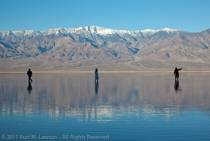
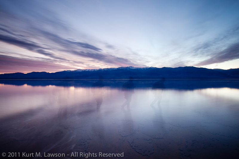
Before sunrise, you can see the very shadow of the Earth as it is chased away by the light. Here I’m looking at a pair of other photographers over by the park’s pull off for Badwater. You can see their little specs on the right of the image. Earth’s gorgeous blue shadow can be seen to the left. Sunrise was imminent.

Day's leading edge

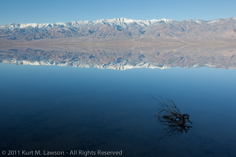
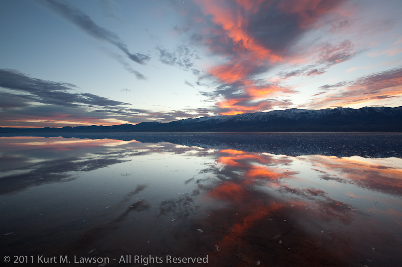
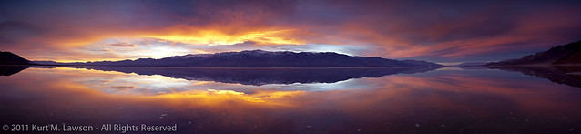
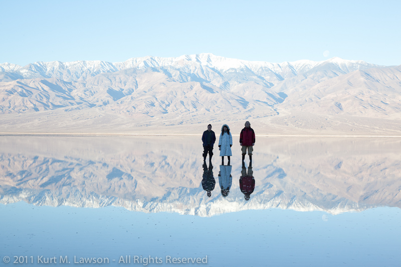
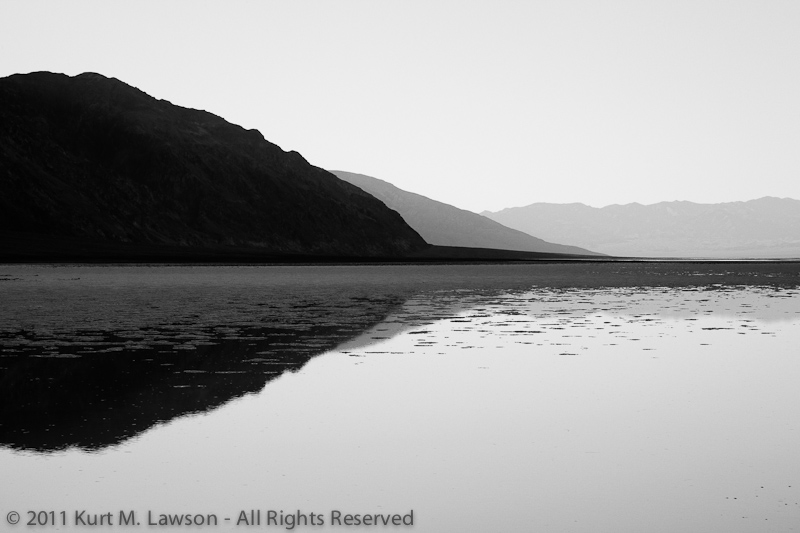
We watched the quiet light on this windless morning until the sun reached all the way down the Panamint Range. The reflections were a perfect mirror. After the light became more harsh, we decided to have some fun doing some self portraits with the reflected water. Our triple self portrait is at the start of this post. Setting the camera to repeatedly take photos, we walked out and held still so that all the ripples would vanish (about 5 minutes). Then we had some fun.

Over there!

Running on Water

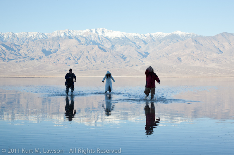
We had a blast, and at the end we were all covered with salty deposits from the splashing water. These photos are challenging because of the light. The entire world around us and the reflections in the water are powered by direct sunlight. Where we were standing was in complete shadow from the Black Mountains behind the camera. Producing anything other than a silhouette stretched the limits of my 5D2’s dynamic range. That’s me on the left!

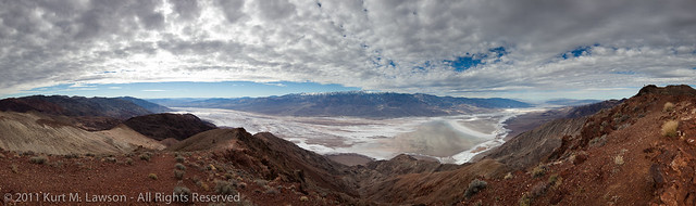
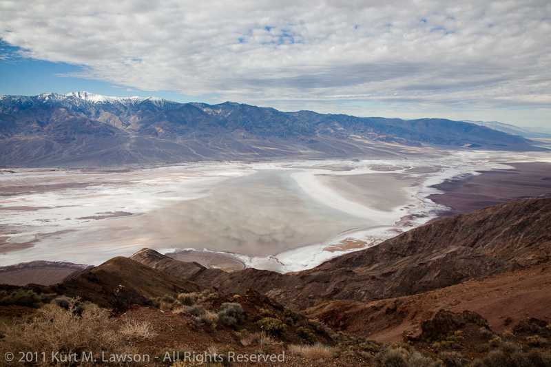
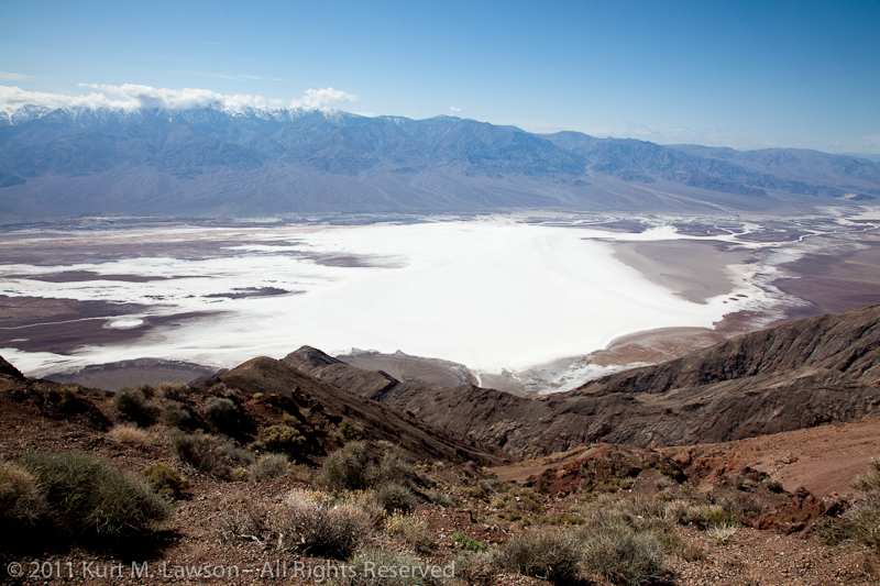
Eventually, we headed in for breakfast to decide where to head next. I usually like to stop at the 49’er cafe in Furnace Creek for a nice big breakfast after running around in the valley all morning. After breakfast, a trip to Dante’s View was in order. This would allow us to get a complete overview of just how much water there was at Badwater and allow us to scout where to head next. And as luck would have it, clouds were building. From a mile up, the extent of the water was made clear. Click for a much bigger version of this panorama.

Death Valley Panorama from Dante's View

The clouds were moving by quickly, casting shadows on the valley floor. I made a time lapse video of the action:

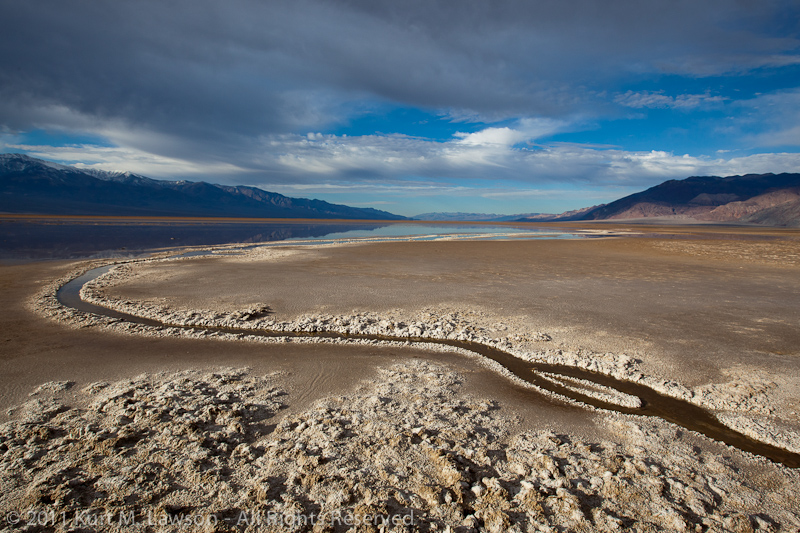
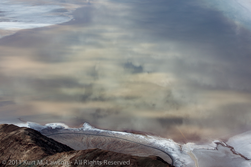
It was beautiful. Looking down below we spotted something weird.

An alien hand reaches into the water

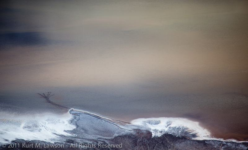
We were certainly disturbing the mud was we walked through the water in the morning. What we didn’t realize was just how visible that would be from above! Here you can clearly see the tracks we made through the water. It looks like an alien hand reaching out from the shore. Fortunately are marks were not permanent as they would disappear once the silt settled, later to be covered with white salt when the water was gone.

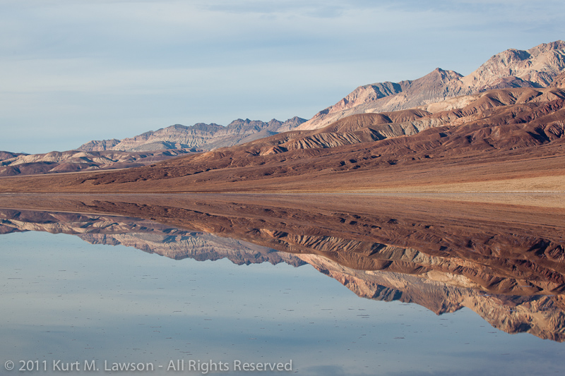
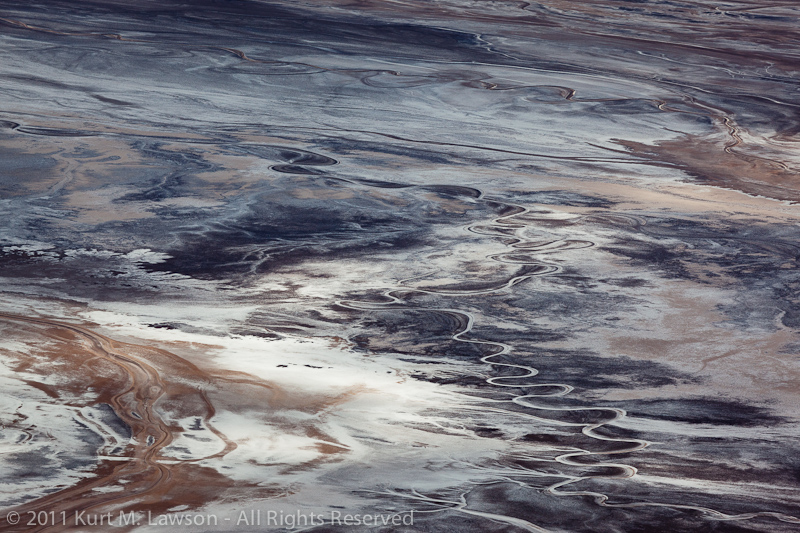
The views below were crazy. The water increased contrast throughout the valley, emphasizing twists and turns of the water as it snaked its way to the lowest place in North America.

Snakes on a plain

Looking down into a brownish reflection of the clouds above, you an make out the main path that park visitors take in the lower right of this image, and our alien hand on the left.

Cloud reflections in a flooded Badwater

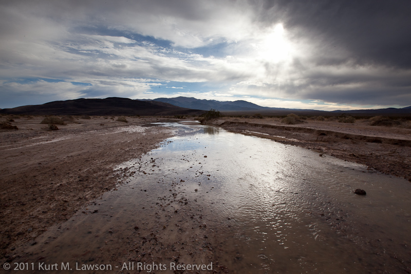
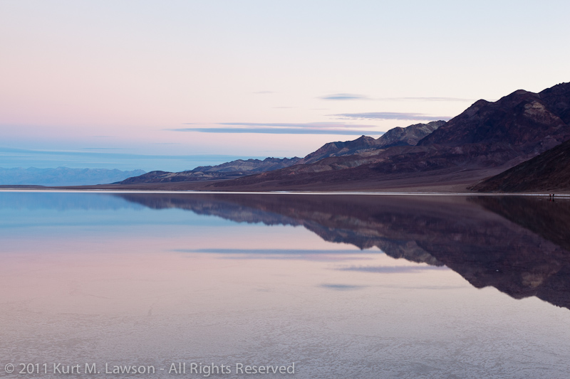
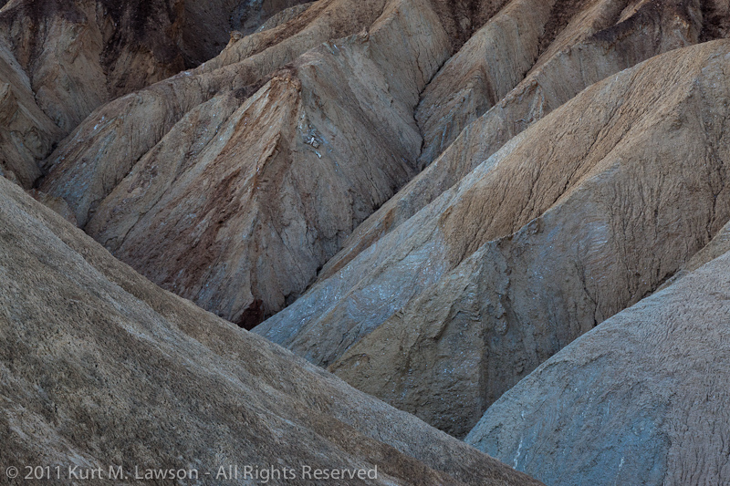
With the cloud cover, we resolved to head back down to Badwater for what could turn into another amazing reflected sunset. On the way back down, a section of the mountains caught my eye.

Folds of rock

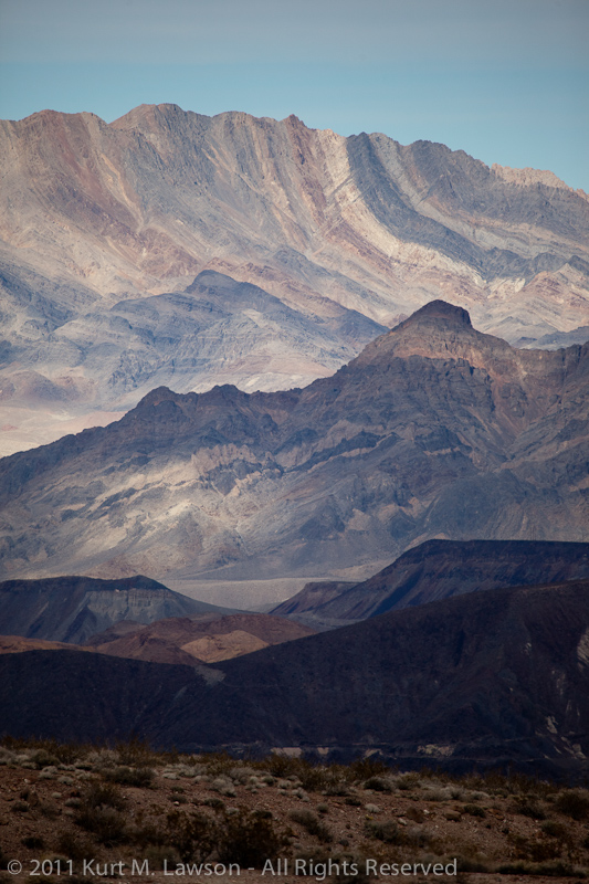
Here you can see the tortured history of the valley laid bare. It’s hard to imagine the forces that would take layers of solid rock and bend them 90 degrees.

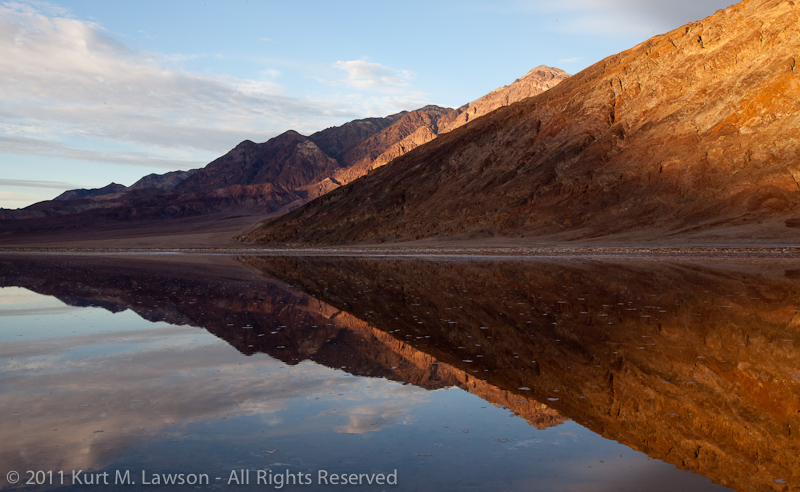
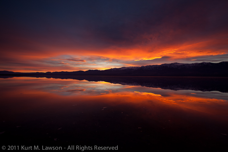
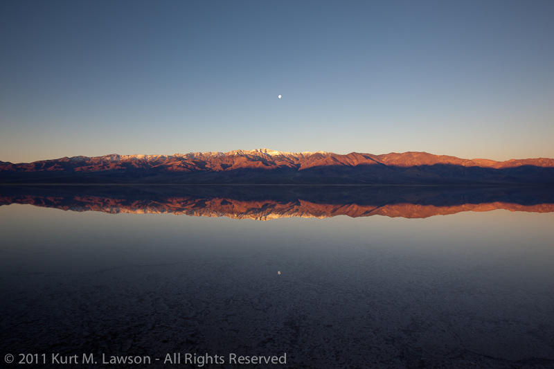
Again the skies of Death Valley blessed us with a wonderful reflected sunset (click for bigger)

Extra glow sunset at Badwater

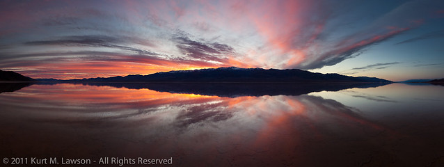
It’s a bit hard to describe what it felt like to be there, standing in a motionless mirror of water while this incredible show happens before your eyes. The reflection really makes it almost like you’re floating in space around planet sunset. It’s really awesome and I hope my photos can convey that on at least some small level. After the sun had set, it became self portrait time again. This is actually one of my favorite pictures from the trip. There are four of me here.

Badwater Self Portrait

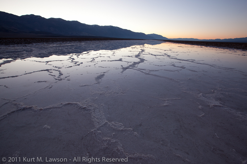
Here is a comparison to show the extent of the flood and what it looks like without any water. In March I returned for a third trip to Death Valley, and once again looked down on Badwater. The view then was completely different. A vast white field of fresh salt deposits replaced the reflecting lake.

Dante's View of a flooded Badwater

Dante's View of a freshly salted Badwater

Poof! The water was gone in just two months. With 6 inches of water (maybe a little more) in January, that’s over 1/2 inch a week sucked up into the dry air.

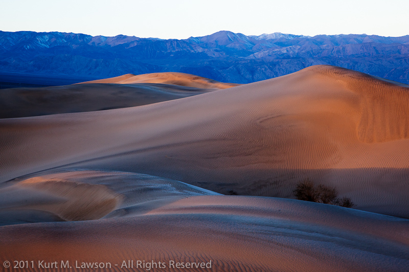
Here are a few more pictures from this wonderful trip

Salty shores and morning haze

Soft shades of erosion

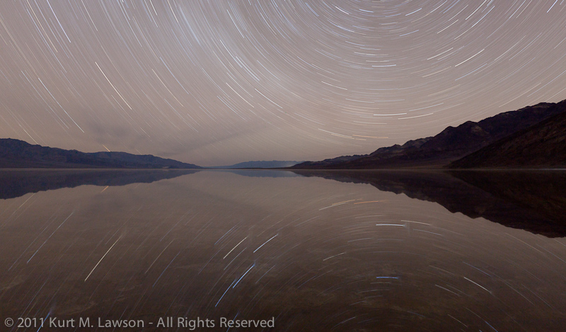
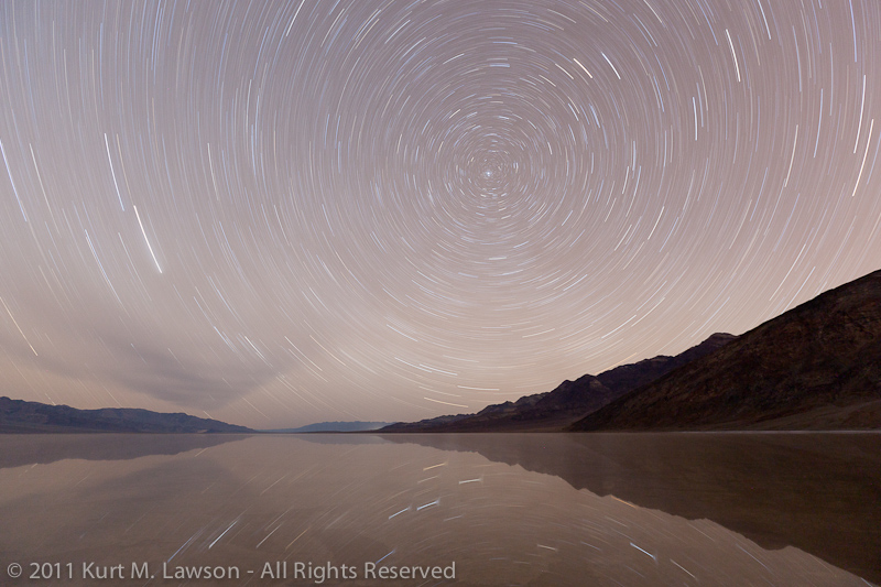
There’s much more to talk about with Death Valley this year, particularly in the realm of star trails. Check back for some more updates from this amazing place.

Tales of a flooded Badwater

Badwater branch

Badwater. The name itself communicates the quality of any water found at this location in Death Valley National Park: bad. The water is incredibly salty. Too salty for any life to live. Perhaps this is the source of the name Death Valley. This place is the deepest spot in the dried up lake bed of ancient Lake Manly. As the water dried up, the salts and minerals of that formerly massive lake gradually accumulated into the salty mess that is spread out throughout the playa for miles around Badwater. Badwater is also the lowest place in North America, lying 282 feet below sea level.

I first visited Death Valley in 2008. I was really starting to break back into my photography after several years of neglect. A friend of mine invited me along on a photo trip and then it was love at first sight. Growing up in the flat lands of northeast Indiana, I had never seen such a harsh, desolate and beautiful landscape. It was really akin to going to another planet. In places there is no plant or animal life to be seen in any direction. The imagination can run wild. One of the photographers in the group had visited Death Valley in 2005 after the “100 year rains” that year. As you can see in this satellite imagery, a small fraction of Lake Manly reformed. The water was so deep that you could actually kayak across the valley becoming the first humans likely to have done this in the history of the Earth. After hearing the stories and seeing images of this flooded landscape, I made a resolution in my mind to revisit Death Valley often, and especially if the flood returned.

Fast forward to December 2010. Southern California experienced a huge drenching rain storm that lasted several days and stretched way up the state. I anxiously looked at the spotty weather radar of Death Valley’s surrounding areas. The rain was very much like I remember in 2005 in southern California, so I was hoping that the valley would be experiencing a similar repeat. At the time, however, I was working like crazy, had family visiting from out of town and then was myself traveling out of town for the holidays. I was determined to go to Death Valley at the earliest possible moment. I flew back to California on January 6, and in the early hours of January 7 I was on the road.

I was not disappointed.

Driving into the park, from the south, I soon started seeing signs of water. The Amargosa River was flowing.

The flowing Amargosa River into Badwater

Continuing on, I found puddles along the road, and even this bizarre river lined with salt which wound off into the distance where I could make out several square miles of water ahead.

A river runs through it

Usually when I visit Death Valley, I will head out into the salty playa around Badwater and north of Furnace Creek in search of puddles of water for reflections. This was water unlike anything I’ve ever seen there. This was not quite 2005 levels, certainly, but the water stretched for miles. Near the actual Badwater turnout in the park, the water was a near perfect mirror. There was no wind at all.

Black Mountains symmetry

Taking a friend’s advice to heart, I had picked up some rubber waders to walk out into the cold water. One might think that Death Valley would be warm, but in the wintertime it gets quite cold at night, and the water does not retain lots of heat. I had planned to set up camp and come back to shoot sunset, but I never made it to camp before dark. I waded out into the water to catch my first mirror reflected sunset:

The wonderful mirror

Amazed at what I saw, I made a plan for the following morning. I thought wrongly that if Badwater had that much water, perhaps the area where Salt Creek impacts the West Side Road would have far more extensive flooding than usual. Unfortunately, it did not.

The river of Salt Creek

It was a nice and quiet sunrise, but I was not satisfied as most winter visits to Death Valley can yield similar images at this location. I headed back to Badwater and shoot the picture at the very top of this post. I then visited an area of the Mesquite Dunes that I have not previously visited, and then headed back to Badwater to wade once again out into the water. Having camera gear over a lake of salty water (much saltier than the Ocean) is a very precarious place to be. Salt water kills electronics and cameras and lenses. It’s highly corrosive, and thus lens changes out there are quite a challenge. Nevertheless I made a few lens changes out there and managed not to drop any gear into the water.

For my second sunset at Badwater, I didn’t know what I was in for. The one the night before I thought was ok, but sometimes it’s just really hard to predict what the clouds are going to do. This was definitely one of those times. I was out early with the late afternoon light. The water again was like glass. No wind! Symmetrical compositions were everywhere.

Afternoon Badwater Symmetry

So, I waited. I practiced the art of standing perfectly still in the water so as to not cause ripples. If I moved my feet, ripples would emanate from my feet and it would take 5 minutes before they would clear to the point where they would not show up in a shot. To shoot sunset, I knew I would have to keep my feet planted and twist at the waist at most. I planted the tripod into the salty mud in a place that I could shoot panoramas. I waited. Finally the sun dipped below the Panamint Range, and still I had no idea about the visual treat that was about to unfold. And then finally, it happened.

Sunset Symmetry

WOW! The sky exploded with color! A dark, symmetrical explosion of color that stretched 180 degrees burst into the sky. I frantically clicked away the shutter. I shot panorama after panorama as the light changed, carefully twisting my body only at the waist (as ripples would have ruined the reflection) and shooting in many cases blindly to the sides. I would pause ever few seconds and just stare wide-mouthed at the scene before me. It was the single most dramatic sunset I’ve ever experienced. Truly amazing. And, I feel as though I captured it. Click below to view the panorama on black (and there is a larger size than that on flickr as well).

WOW

I was blown away. I stayed until it got dark, and just was mesmerized by the experience. I said “Thank you!” aloud to the landscape, and I was nothing but smiles. I headed back to camp. This night would not be a usual one, however. I had plans for the darkness. I had shot some star trails the night before at the Devil’s Golf Course. I headed out again to do the same at Badwater. I went to sleep at around 7 pm. I woke up at midnight. I headed straight for Badwater in the darkness. The moon was not up at all. I went to the same peninsula from where I had shot the sunset a few hours before. Alone in the dark I carried my camera gear out to see what would happen. I set up a couple of film cameras for some multi-hour exposures, and set up my 5D2 for some quicker star trails. I set the timer to wait a couple minutes and then take a 45 minute exposure. I waited then in my car, in the dark. With the long exposure noise reduction feature on modern DSLRs, I knew I was in for another 45 minutes of wait time once the exposure was made. As soon as the shutter closed I waded out into the water and retrieved my camera. I left the film gear out there and drove to Zabriskie Point thinking I would do another digital star trail shot while the film cameras continued to soak up the light. When I got to Zabriskie, I waited for the camera to produce the image. When it did I nearly flipped. There in the dark on my tiny little 3″ screen was this:

Star Trail Symmetry

Instantly any thoughts of shooting more star trails anywhere else evaporated like a cup of water in a Death Valley July. I raced back to Badwater and plopped the camera back in a nearly identical spot, and this time aimed to include the North Star.

Star trail reflection on a windless night

For the second time in less than 12 hours, a flooded Badwater in Death Valley had utterly blown me away. Amazingly, both of these shots were taken with virtually no wind. In the second one, at the very end of the exposure there is some wind causing ripples which broaden the reflected star trail lines, but overall it’s a near perfect reflection. This is a side of Death Valley that I had never seen. I had never seen star trail pictures with perfect water reflections before. The second star trail image is my most viewed image on flickr. It has the highest “interestingness” rating there in my work as well, and was (along with the “WOW” panorama) in the “Explore” section for the days they were posted.

After shooting the star trails, I should have stayed and shot sunrise there. I had other ideas though and headed for the dunes for my morning. While there were no reflections to be found amongst the piles of sand, there was one additional thing that I had never seen before here. There was frost in the sand.

The edge of frosted sand

The frost added some interesting highlights to the sand in the morning light.

Orange frosted dunes

After one final 3-mile hike into the center of the valley near Salt Creek, I headed back to home. I was nothing but smiles even through the hours that I was behind the wheel. Waking up at midnight did make for a seriously long day, but the rewards will last me a lifetime.

My next post will detail my return trip just two weeks later, and then after that I have some exciting trips to Joshua Tree, and Channel Islands to share. Stay tuned.